Midday Nowcast: Warm and Breezy Monday
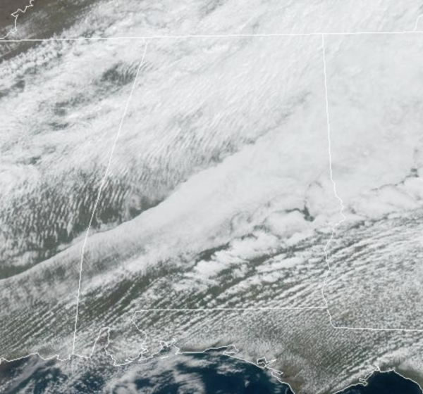
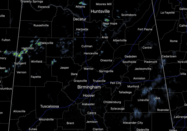
An active weather of weather ahead for Alabama with the threat of severe storms possible on multiple days this week…For today, we continue to have a wind advisory in effect for the northern 2/3 of the state as winds could gust this afternoon in the 30-40 mph range. We are seeing a mix of sun and clouds with afternoon temperatures in upper 70s to lower 80s. Some showers are on the radar this afternoon, but nothing too heavy or widespread.
RIP CURRENT AWARENESS WEEK: For all of us that love to visit the beautiful beaches of Alabama and Northwest Florida, NWS Mobile and NWS Tallahassee are once again teaming up for the 3rd Annual Gulf Coast Rip Current Awareness Week, today through Friday. The most important message is to raise awareness about the dangers of rip currents right before the start of the spring break season.
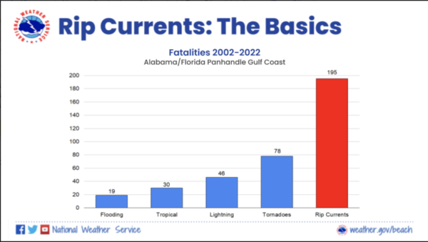
Rip currents remain the number one weather related killer along the northern Gulf Coast. There have been a combined 195 rip current related fatalities that have been documented along the Alabama and Florida Panhandle Gulf Coast since 2002, which remains more than those from flooding, tropical, lightning, and tornadoes combined. The majority of rip current related fatalities are visitors, so a large part of our efforts in this awareness week is to try and reach people before their feet hit the sand.
TUESDAY: Tomorrow will be dry across the state as we will be in between systems. It will be another warm day with more clouds than sunshine; highs in the upper 70s to lower 80s.
WEDNESDAY: The SPC (Storm Prediction Center) has introduced a “marginal risk” (level 1/5) of severe thunderstorms for the northern 2/3 of Alabama Wednesday. Scattered storms that form Wednesday afternoon/evening could produce small hail and strong, gusty winds. Otherwise, Wednesday will be a warm day with more clouds than sun and highs will surge into the 80s in most locations again.
THURSDAY/FRIDAY: Another warm and breezy day is in the forecast Thursday, with highs likely again heading into the lower 80s. Some showers will be possible at times, but our main concern will come with an approaching storm system Thursday night into Friday. This system will bring a higher threat of severe storms to Alabama. The SPC has much of the state covered in a severe weather risk during the time frame, in fact, parts of Alabama are included in what will likely be an “enhanced risk” (level 3 of 5) of severe storms during this time frame.
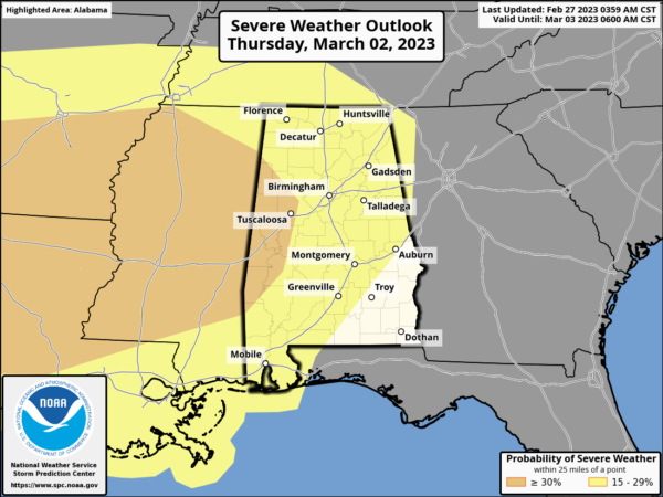
Most of Thursday will be fine when it comes to a threat of severe storms. The threat arrives overnight Thursday and into early Friday morning…for now now we are going with a 9PM-9AM window. All types of severe weather will be possible, but the main threat will come from damaging straight line winds. But, a tornado or two can’t be ruled out based on the forecast wind profiles. Still several days away, and we will get a better understanding of the overall impacts and timing as the system gets closer and the short-range, mesoscale models start to see the system. Just be prepared for the likelihood of an overnight severe weather threat later this week.
The system will be quickly exiting the state early Friday, with a clearing sky, cooler temperatures, and breezy conditions, with highs in the 60s, which are closer to average for this time of year.
WEEKEND WEATHER: A gorgeous but chillier weekend of weather is in store for Alabama with dry, sunny days and clear cold nights. Lows drop into the 30s over the northern half of the state, and colder spots across North Alabama could be close to freezing early Sunday morning. Highs will be in the 55-65 degree range Saturday, and generally in the 60s Sunday.
BEACH FORECAST CENTER: Get the latest weather and rip current forecasts for the beaches from Fort Morgan to Panama City on our Beach Forecast Center page. There, you can select the forecast of the region that you are interested in visiting.
WORLD TEMPERATURE EXTREMES: Over the last 24 hours, the highest observation outside the U.S. was 112.8F at Ondangwa, Namibia. The lowest observation was -65.2F at Vostok, Antarctica.
CONTIGUOUS TEMPERATURE EXTREMES: Over the last 24 hours, the highest observation was 99F at Rio Grande Village, TX. The lowest observation was -18F at Ripogenous Dam, ME.
Category: Alabama's Weather, ALL POSTS
About the Author (Author Profile)
Macon, Georgia Television Chief Meteorologist, Birmingham native, and long time Contributor on AlabamaWX. Stormchaser. I did not choose Weather, it chose Me. College Football Fanatic. @Ryan_StinnetSubscribe
If you enjoyed this article, subscribe to receive more just like it.


