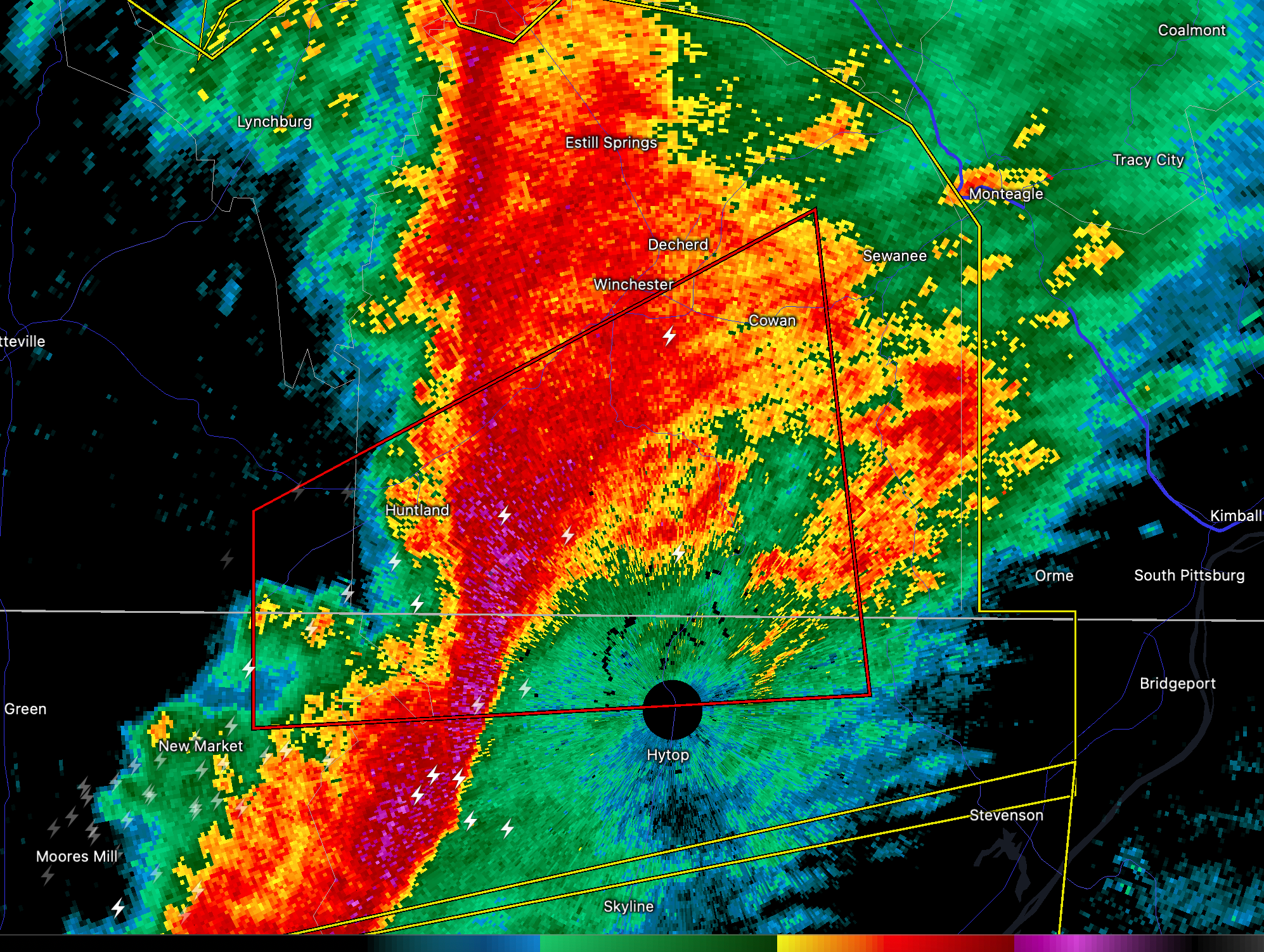
Tornado Warning for Alabama’s Jackson and Madison Counties Until 1230 p.m.
The National Weather Service in Huntsville Alabama has issued a
* Tornado Warning for…
Northwestern Jackson County in northeastern Alabama…
Northeastern Madison County in north central Alabama…
Southeastern Lincoln County in Middle Tennessee…
Southern Franklin County in Middle Tennessee…
* Until 1230 PM CST.
* At 1154 AM CST, a severe thunderstorm capable of producing a
tornado was located near Huntland, or 14 miles northeast of Moores
Mill, moving northeast at 60 mph.
HAZARD…Tornado.
SOURCE…Radar indicated rotation.
IMPACT…Flying debris will be dangerous to those caught without
shelter. Mobile homes will be damaged or destroyed.
Damage to roofs, windows, and vehicles will occur. Tree
damage is likely.
* This dangerous storm will be near…
Huntland around 1200 PM CST.
Cowan around 1215 PM CST.
Other locations impacted by this tornadic thunderstorm include Elora,
Francisco, Maxwell, Beans Creek, Belvidere and Jericho.
PRECAUTIONARY/PREPAREDNESS ACTIONS…
TAKE COVER NOW! Move to a basement or an interior room on the lowest
floor of a sturdy building. Avoid windows. If you are outdoors, in a
mobile home, or in a vehicle, move to the closest substantial shelter
and protect yourself from flying debris.
Category: Alabama's Weather, ALL POSTS, Severe Weather
About the Author (Author Profile)
Bill Murray is the President of The Weather Factory. He is the site's official weather historian and a weekend forecaster. He also anchors the site's severe weather coverage. Bill Murray is the proud holder of National Weather Association Digital Seal #0001 @wxhistorianSubscribe
If you enjoyed this article, subscribe to receive more just like it.


