Severe Thunderstorm Warning for Shelby, Etowah, St. Clair Counties Until 1:30 p.m.
The National Weather Service in Birmingham has issued a
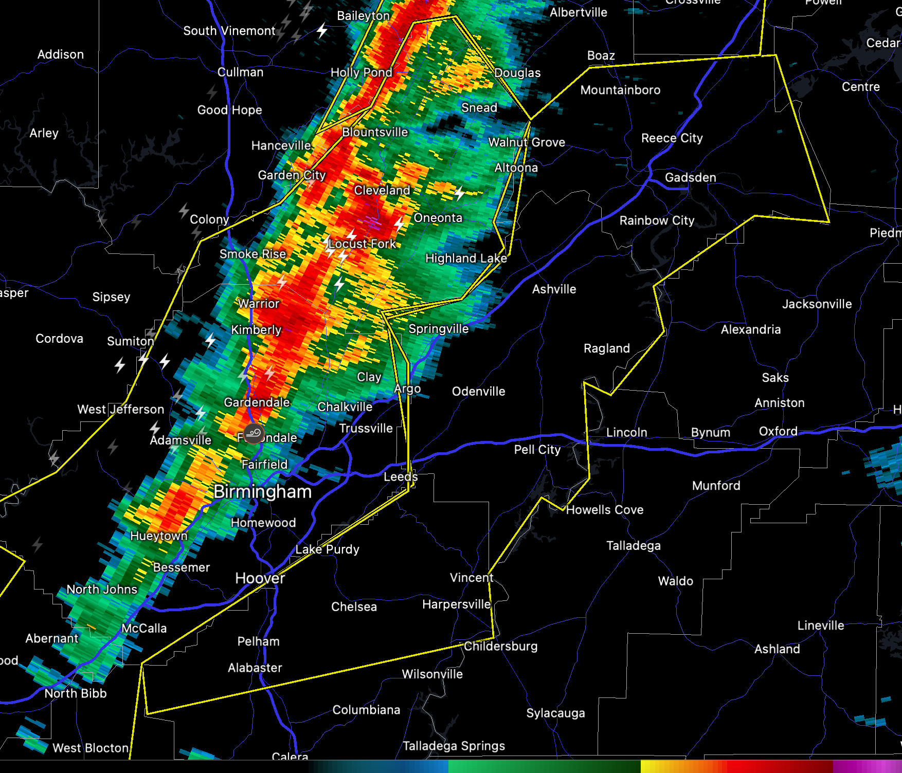
* Severe Thunderstorm Warning for…
Central Shelby County in central Alabama…
Etowah County in northeastern Alabama…
St. Clair County in central Alabama…
* Until 130 PM CST.
* At 1205 PM CST, severe thunderstorms were located along a line
extending from near Strawberry to near Fultondale to near Eoline,
moving east at 45 mph.
HAZARD…60 mph wind gusts.
SOURCE…Radar indicated.
IMPACT…Expect damage to roofs, siding, and trees.
* Locations impacted include…
Hoover, Gadsden, Alabaster, Pelham, Helena, Pell City, Leeds,
Moody, Chelsea, Rainbow City, Attalla, Hokes Bluff, Springville,
Odenville, Wilsonville, Lincoln, Glencoe, Margaret, Argo and Indian
Springs Village.
Category: Alabama's Weather, ALL POSTS, Severe Weather
About the Author (Author Profile)
Bill Murray is the President of The Weather Factory. He is the site's official weather historian and a weekend forecaster. He also anchors the site's severe weather coverage. Bill Murray is the proud holder of National Weather Association Digital Seal #0001 @wxhistorianSubscribe
If you enjoyed this article, subscribe to receive more just like it.


