Midday Nowcast: Rain Returns Later Today into Tonight
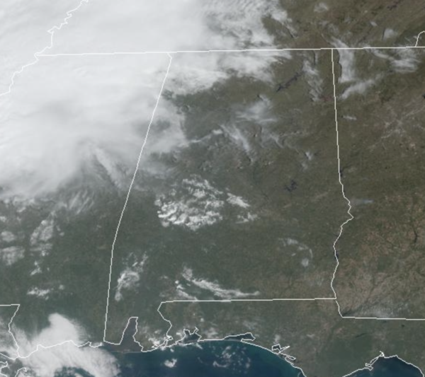
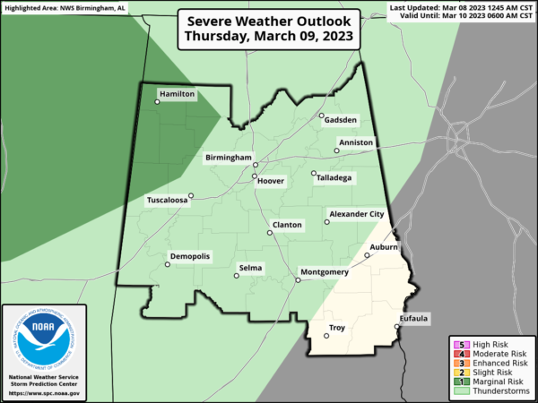
Cooler air is dropping into the northern half of Alabama today, and we are see a large temperature range across the state with 60s over the northern portions and 80s down south. For the most part it is a dry day, but clouds are on the increase and rain will return to Alabama later today and tonight. Through tomorrow, expect periods of rain with temperatures in the 50s and 60s across North/Central Alabama. We note, the SPC has introduced a low end threat of severe storms into West Alabama, and this will be for some elevated thunderstorms, that could produce some hail tomorrow.
The rain will linger into Friday, ending from northwest to southeast by midday and through the afternoon. Friday’s high will be in the mid to upper 60s.
ACROSS THE USA: A storm will track from west to east across the center of the nation today. Heavy snow is forecast for the Plains, Midwest and Great Lakes region Thursday into Friday; Rain, locally heavy, and thunderstorms from the Southern Plains, lower Mississippi and Tennessee Valley. Heavy precipitation will track into the West Coast with more rain, flooding and heavy high elevation snow through the weekend.
THE ALABAMA WEEKEND: Saturday will be mainly dry with highs in the 50s and 60s and more sun than clouds. On Sunday, a quick moving system will bring rain and a few thunderstorms back to the state by Sunday afternoon and Sunday night. There could be a few strong storms with this feature; highs Sunday afternoon will be in the 60s and 70s.
NEXT WEEK: The weather still looks dry Monday through Thursday, with temperatures on a downward trend, and actually well-below average for mid-March. Potential for a late season freeze is increasing Tuesday and Wednesday morning over the northern half of Alabama. Wednesday morning looks to be the coldest with lows in the 25-35 degree range. We warm up by the end of the week, and rain will likely return by Friday along with some risk of thunderstorms.
BEACH FORECAST CENTER: Get the latest weather and rip current forecasts for the beaches from Fort Morgan to Panama City on our Beach Forecast Center page. There, you can select the forecast of the region that you are interested in visiting.
WORLD TEMPERATURE EXTREMES: Over the last 24 hours, the highest observation outside the U.S. was 110.1F at Matam, Senegal. The lowest observation was -85.0F at Vostok, Antarctica.
CONTIGUOUS TEMPERATURE EXTREMES: Over the last 24 hours, the highest observation was 99F at Rio Grande Village, TX. The lowest observation was -28F at Peter Sinks, UT.
Category: Alabama's Weather, ALL POSTS
About the Author (Author Profile)
Macon, Georgia Television Chief Meteorologist, Birmingham native, and long time Contributor on AlabamaWX. Stormchaser. I did not choose Weather, it chose Me. College Football Fanatic. @Ryan_StinnetSubscribe
If you enjoyed this article, subscribe to receive more just like it.


