Midday Nowcast: Rain and Some Rumbles of Thunder
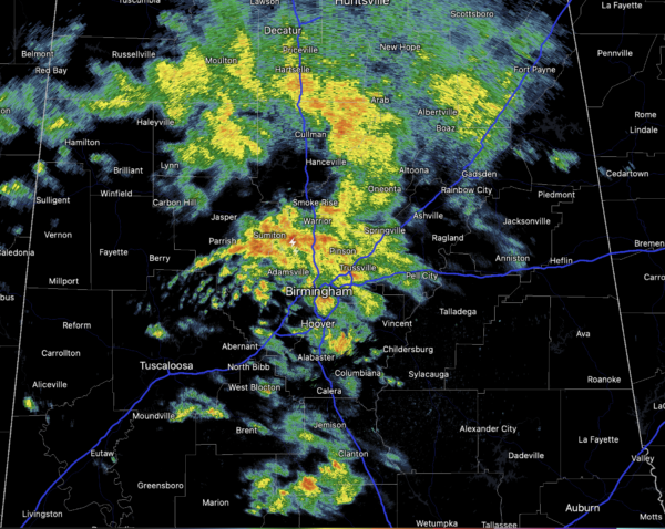
Rain and a few thunderstorms remain in the forecast today. It is rather cool and rainy day with widespread rain and temperatures are in the upper 50s and lower 60s across North/Central Alabama. South Alabama continues to bask in the 70s and 80s.

There remains the low chance of an isolated severe storm today and the SPC maintains a “marginal risk” (level 1/5) of severe storms for parts of West Alabama this afternoon. Storms there will be elevated, not surface based, and the main threat will come from hail and gusty winds.
FOR FRIDAY: The rain will end from the northwest during the day tomorrow as a cold front moves through. By afternoon most of the showers will be across South Alabama, and the sky begins to clear over the northern counties. Highs tomorrow will be in the 60s for most locations.
ACROSS THE USA: Heavy rain with flooding, significant snow and strong winds will impact the west through Friday as a powerful storm moves ashore. Meanwhile, another system tracking across the center of the nation will bring accumulating snow across the central and northern Plains through the lower Great Lakes region. For the State of Hawaii, strong winds and dangerous surf conditions are in the forecast.
THE ALABAMA WEEKEND: Saturday will be mainly sunny and dry with highs in the 60s. On Sunday, a quick moving system will bring rain and a few thunderstorms back to the state by Sunday afternoon and Sunday night. There could be a few strong storms with this feature, especially across South Alabama; highs Sunday afternoon will be in the 60s and 70s.
NEXT WEEK: The weather still looks dry Monday through Thursday, with temperatures below average for mid-March. Potential for a late season freeze is increasing Tuesday and Wednesday morning over the northern half of Alabama. Wednesday morning looks to be the coldest with lows in the 25-35 degree range. Highs will be in the 50s to start the week, but we warm up by the end of the week, and rain will likely return by Friday along with some risk of thunderstorms.
BEACH FORECAST CENTER: Get the latest weather and rip current forecasts for the beaches from Fort Morgan to Panama City on our Beach Forecast Center page. There, you can select the forecast of the region that you are interested in visiting.
WORLD TEMPERATURE EXTREMES: Over the last 24 hours, the highest observation outside the U.S. was 113.0F at Linguere, Senegal. The lowest observation was -76.9F at Vostok, Antarctica.
CONTIGUOUS TEMPERATURE EXTREMES: Over the last 24 hours, the highest observation was 96F at Zapata, TX. The lowest observation was -13F at Peter Sinks, UT.
Category: Alabama's Weather, ALL POSTS
About the Author (Author Profile)
Macon, Georgia Television Chief Meteorologist, Birmingham native, and long time Contributor on AlabamaWX. Stormchaser. I did not choose Weather, it chose Me. College Football Fanatic. @Ryan_StinnetSubscribe
If you enjoyed this article, subscribe to receive more just like it.


