Severe Thunderstorm Warning for Greene, Marengo, and Hales Counties Until 9 p.m.
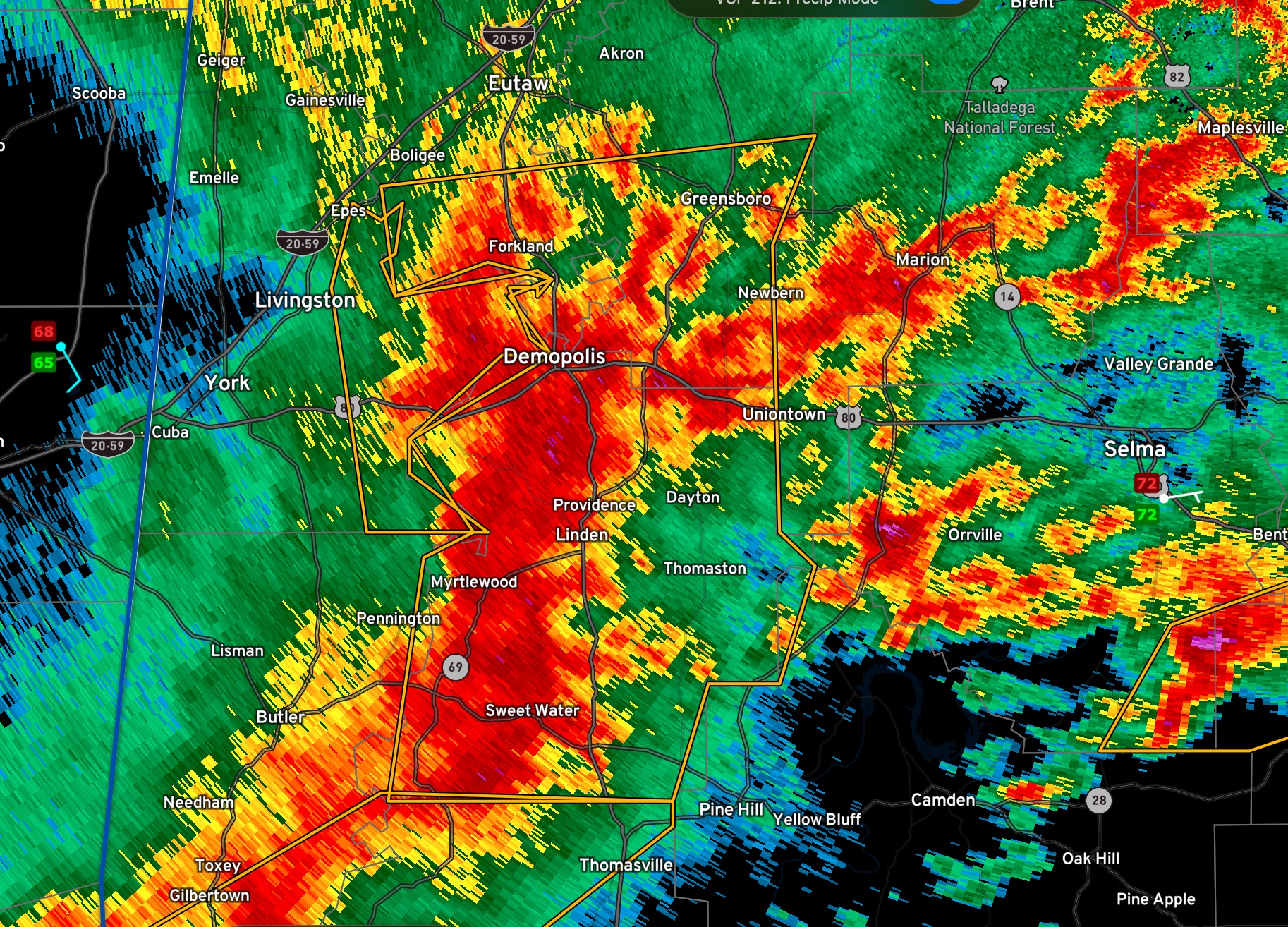
…A SEVERE THUNDERSTORM WARNING REMAINS IN EFFECT UNTIL 900 PM CDT
FOR MARENGO…SOUTHEASTERN GREENE AND SOUTHERN HALE COUNTIES…
At 810 PM CDT, severe thunderstorms were located along a line
extending from Walden Quarters to 8 miles southwest of Thomasville,
moving east at 45 mph.
HAZARD…60 mph wind gusts and quarter size hail.
SOURCE…Radar indicated.
IMPACT…Hail damage to vehicles is expected. Expect wind damage to
roofs, siding, and trees.
Locations impacted include…
Demopolis, Greensboro, Linden, Jefferson, Forkland, Thomaston, Sweet
Water, Newbern, Myrtlewood, Faunsdale, Dayton, Nanafalia, Consul,
Thornhill, Arcola, Surginer, Tishabee, Putnam, Freddie Jones Field
and Greensboro Municipal Airport.
PRECAUTIONARY/PREPAREDNESS ACTIONS…
A Tornado Watch remains in effect until 100 AM CDT for south central,
central, southwestern and west central Alabama.
For your protection move to an interior room on the lowest floor of a
building.
Category: Alabama's Weather, ALL POSTS, Severe Weather
About the Author (Author Profile)
Bill Murray is the President of The Weather Factory. He is the site's official weather historian and a weekend forecaster. He also anchors the site's severe weather coverage. Bill Murray is the proud holder of National Weather Association Digital Seal #0001 @wxhistorianSubscribe
If you enjoyed this article, subscribe to receive more just like it.


