Severe Thunderstorm Warning for Dallas County Until 930 p.m.: TORNADO POSSIBLE
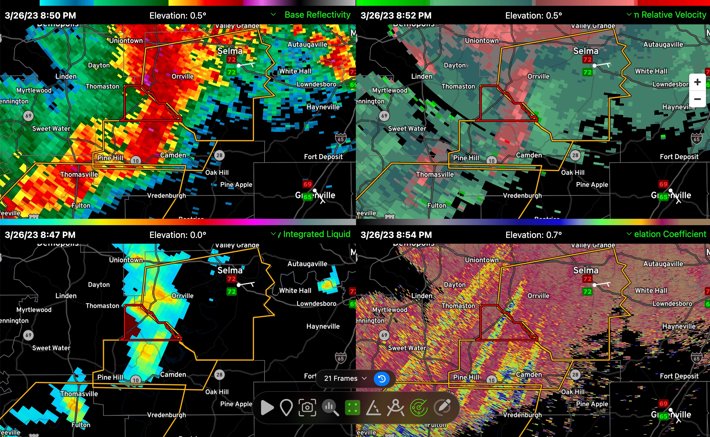
Watching a dangerous storm coming out of Wilcox County into Dallas County with a comma head feature that could produce spin-up tornadoes.
The storm is riding a warm frontal boundary which makes it especially concerning.
The warning includes Selma, but for now, the feature is moving more east than northeast. That could change with the structure of the storm, so all of Dallas County needs to be vigilant.
The National Weather Service in Birmingham has issued a
* Severe Thunderstorm Warning for…
Dallas County in south central Alabama…
* Until 930 PM CDT.
* At 846 PM CDT, severe thunderstorms were located along a line
extending from near Bogue Chitto to near Camden, moving east at 50
mph.
HAZARD…60 mph wind gusts and penny size hail.
SOURCE…Radar indicated.
IMPACT…Expect damage to roofs, siding, and trees.
* Locations impacted include…
Selma, Selmont-West Selmont, Orrville, Bogue Chitto, Gardner
Island, Tyler, Old Cahaba Park, Dannelly Reservoir, Dallas County
Horse Arena, Belknap, Dallas Lake, Memorial Stadium, Burnsville,
Potter Station, Carlowville, Safford, Hazen, Minter, Craig Field
Aiport and Selma Drag Strip.
PRECAUTIONARY/PREPAREDNESS ACTIONS…
A Tornado Watch remains in effect until 100 AM CDT for central and
south central Alabama.
For your protection move to an interior room on the lowest floor of a
building.
Category: Alabama's Weather, ALL POSTS, Severe Weather
About the Author (Author Profile)
Bill Murray is the President of The Weather Factory. He is the site's official weather historian and a weekend forecaster. He also anchors the site's severe weather coverage. Bill Murray is the proud holder of National Weather Association Digital Seal #0001 @wxhistorianSubscribe
If you enjoyed this article, subscribe to receive more just like it.


