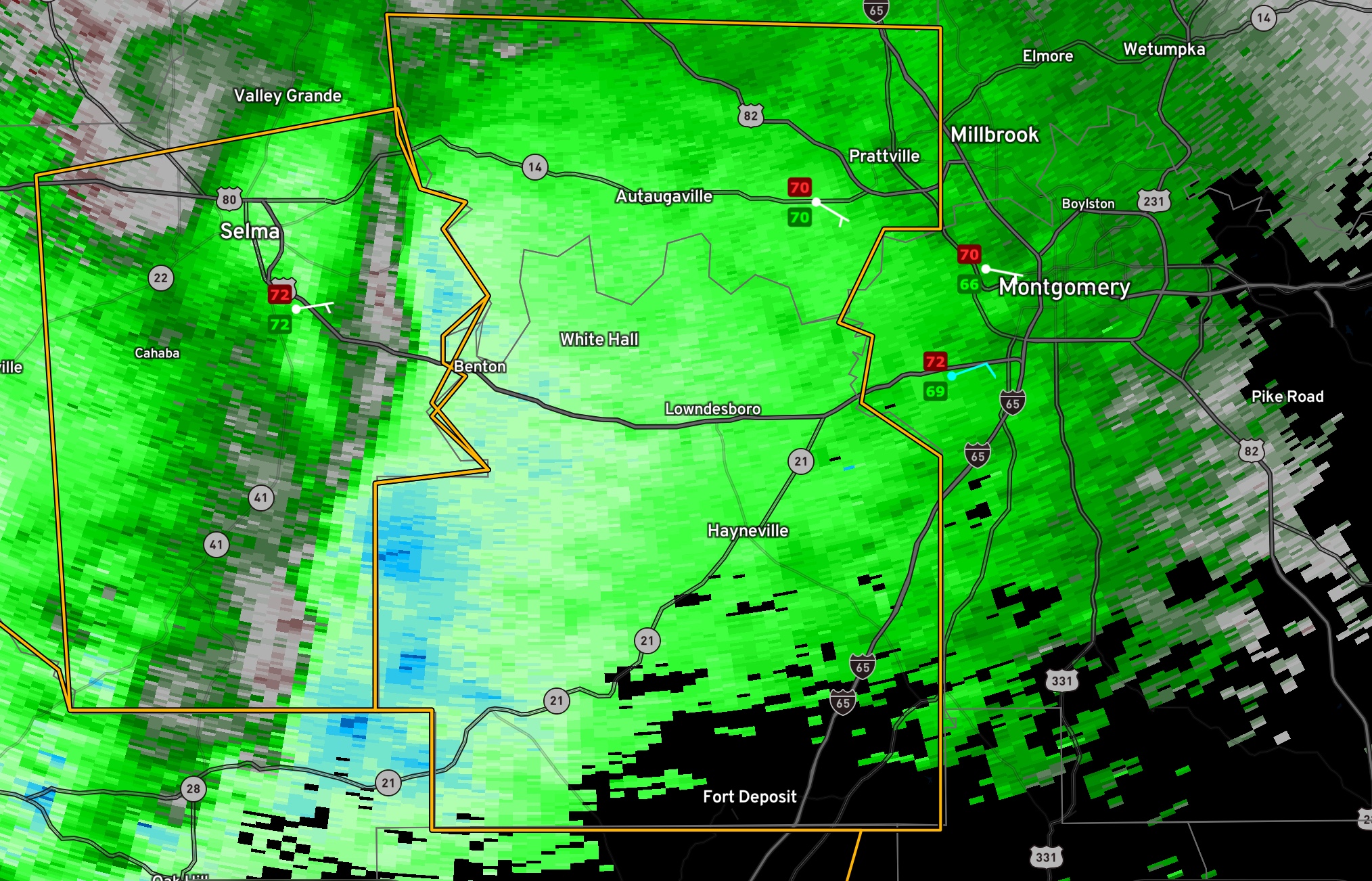
Severe Thunderstorm Warning Autauga, Lowndes Counties: 60-70 mph Winds Approaching
Doppler radar indicates very strong winds of 60-70 mph are approaching Autauga and Lowndes Counties from Dallas County.
Winds gusted to 46 mph on the northern end of the storms at Craig Field in Selma.
The National Weather Service in Birmingham has issued a
* Severe Thunderstorm Warning for…
Central Autauga County in central Alabama…
Lowndes County in south central Alabama…
* Until 1015 PM CDT.
* At 915 PM CDT, severe thunderstorms were located along a line
extending from near Burnsville to 10 miles southeast of Belknap,
moving east at 55 mph.
HAZARD…60 mph wind gusts.
SOURCE…Radar indicated.
IMPACT…Expect damage to roofs, siding, and trees.
* Locations impacted include…
Prattville, Millbrook, Fort Deposit, Mosses, Hayneville,
Autaugaville, White Hall, Gordonville, Lowndesboro, Benton, Booth,
Beechwood, Autauga County Airport, Mulberry, Lowndes County
Airport, Logan, Calhoun, Robert F. Henry Lock And Dam, Clover Hill
and Farmersville.
PRECAUTIONARY/PREPAREDNESS ACTIONS…
A Tornado Watch remains in effect until 100 AM CDT for central, south
central and east central Alabama.
For your protection move to an interior room on the lowest floor of a
building.
Torrential rainfall is occurring with these storms, and may lead to
flash flooding. Do not drive your vehicle through flooded roadways.
Category: Alabama's Weather, ALL POSTS, Severe Weather
About the Author (Author Profile)
Bill Murray is the President of The Weather Factory. He is the site's official weather historian and a weekend forecaster. He also anchors the site's severe weather coverage. Bill Murray is the proud holder of National Weather Association Digital Seal #0001 @wxhistorianSubscribe
If you enjoyed this article, subscribe to receive more just like it.


