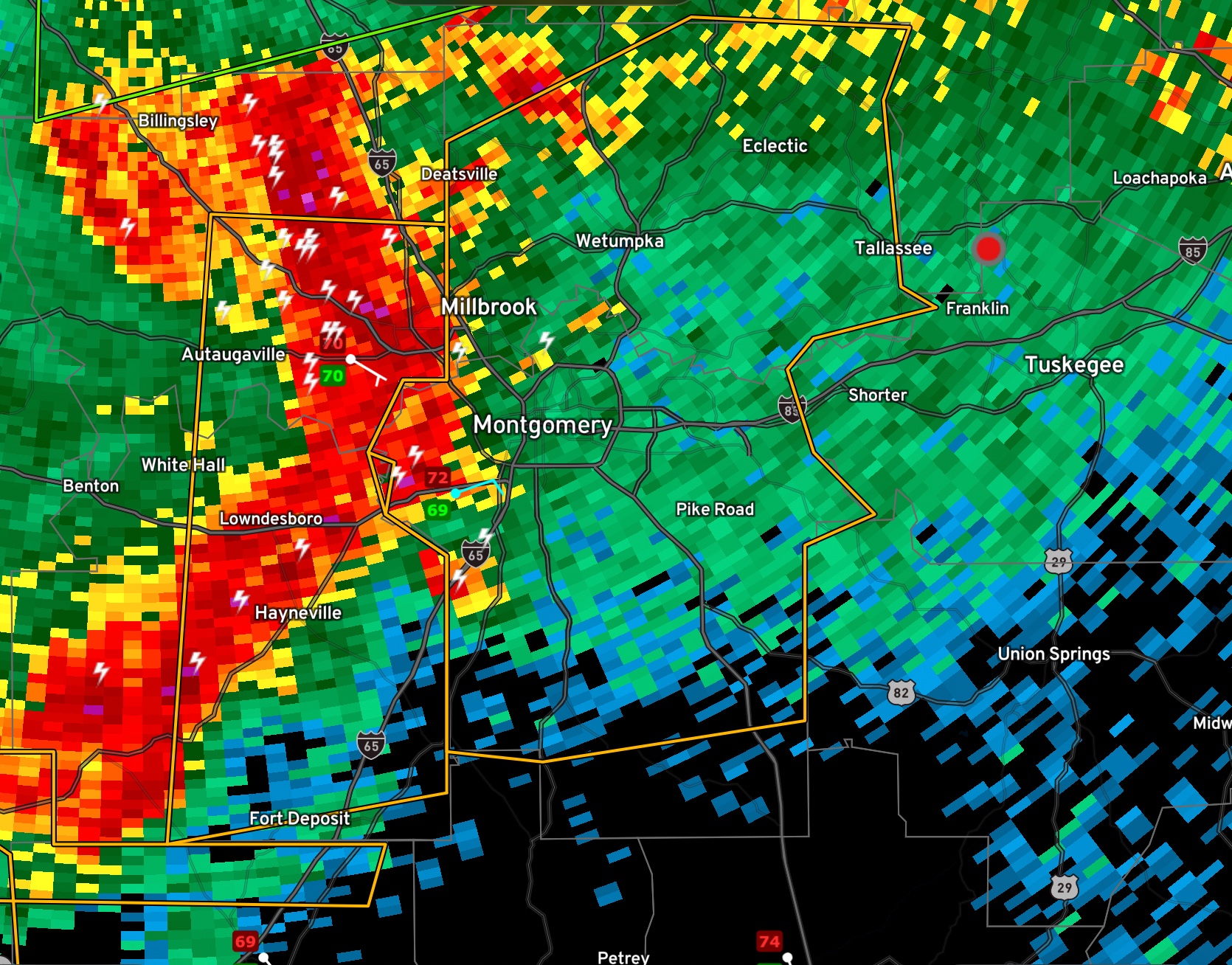
Severe Thunderstorm Warning for Parts of Elmore and Montgomery Counties until 10:15 p.m.
The National Weather Service in Birmingham has issued a
* Severe Thunderstorm Warning for…
Elmore County in east central Alabama…
Montgomery County in south central Alabama…
* Until 1015 PM CDT.
* At 935 PM CDT, severe thunderstorms were located along a line
extending from near Vida Junction to Beechwood, moving east at 55
mph.
HAZARD…60 mph wind gusts.
SOURCE…Radar indicated.
IMPACT…Expect damage to roofs, siding, and trees.
* Locations impacted include…
Montgomery, Prattville, Millbrook, Wetumpka, Tallassee, Meadville,
Pike Road, Elmore, Coosada, Deatsville, Eclectic, Hyundai Motors Of
Alabama, Santuck, Auburn University In Montgomery, Woodcrest,
Snowdoun, Sellers, Ten Cedar Estates, Waugh and Dexter.
PRECAUTIONARY/PREPAREDNESS ACTIONS…
A Tornado Watch remains in effect until 100 AM CDT for central, south
central, southeastern and east central Alabama.
For your protection move to an interior room on the lowest floor of a
building.
Torrential rainfall is occurring with these storms, and may lead to
flash flooding. Do not drive your vehicle through flooded roadways.
Category: Alabama's Weather, ALL POSTS, Severe Weather
About the Author (Author Profile)
Bill Murray is the President of The Weather Factory. He is the site's official weather historian and a weekend forecaster. He also anchors the site's severe weather coverage. Bill Murray is the proud holder of National Weather Association Digital Seal #0001 @wxhistorianSubscribe
If you enjoyed this article, subscribe to receive more just like it.


