Severe Thunderstorm Warning for Parts of Chambers, Coosa, Lee, Macon, Randolph, Tallapoosa Counties till 11:30 PM CDT
There is a possibility of spin-up tornadoes with this mesoscale convective vortex, so be in a safe place when the storms approach. It will not be possible for the NWS to catch every one with a tornado warning.
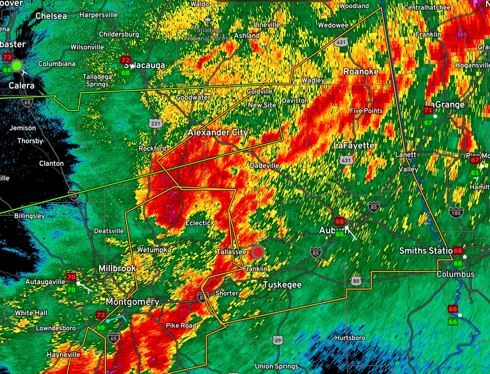
The National Weather Service in Birmingham has issued a
* Severe Thunderstorm Warning for…
Lee County in east central Alabama…
Southern Randolph County in east central Alabama…
Macon County in southeastern Alabama…
Tallapoosa County in east central Alabama…
Chambers County in east central Alabama…
Southeastern Coosa County in east central Alabama…
* Until 1130 PM CDT.
* At 1008 PM CDT, severe thunderstorms were located along a line
extending from near Nixburg to Martin Dam to near Shorter, moving
east at 60 mph.
HAZARD…60 mph wind gusts.
SOURCE…Radar indicated.
IMPACT…Expect damage to roofs, siding, and trees.
* Locations impacted include…
Auburn, Opelika, Alexander City, Tuskegee, Valley, Lanett, Roanoke,
Tallassee, Dadeville, Camp Hill, Notasulga, Smiths, Equality,
Stroud, Milstead, Lafayette, Smiths Station, La Fayette, Jacksons’
Gap and New Site.
PRECAUTIONARY/PREPAREDNESS ACTIONS…
A Tornado Watch remains in effect until 100 AM CDT for south central,
southeastern and east central Alabama.
For your protection move to an interior room on the lowest floor of a
building.
Torrential rainfall is occurring with these storms, and may lead to
flash flooding. Do not drive your vehicle through flooded roadways.
Category: Alabama's Weather, ALL POSTS, Severe Weather
About the Author (Author Profile)
Bill Murray is the President of The Weather Factory. He is the site's official weather historian and a weekend forecaster. He also anchors the site's severe weather coverage. Bill Murray is the proud holder of National Weather Association Digital Seal #0001 @wxhistorianSubscribe
If you enjoyed this article, subscribe to receive more just like it.


