Midday Nowcast: A Couple of Dry Day; Storms Return Friday Night
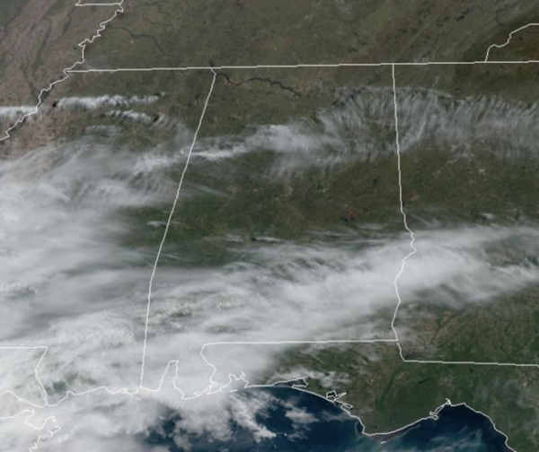
Dry air covers much of North/Central Alabama today and tomorrow; we are seeing a more sun than clouds, and clear cool nights. Highs today are in the upper 60s and lower 70s. Tonight will be clear and chilly once again with lows in the upper 30s and lower 40s. Tomorrow, with plenty of sunshine, expect highs to surge into mid 70s for most locations.
FRIDAY: The day will be dry, with warm and breezy conditions, afternoon highs are very likely to reach the lower 80s. A significant severe weather event will occur during the day Friday north and west of Alabama, and those storms will move into Alabama late Friday night.
STORMS RETURN: Rain and thunderstorms will push into the state late Friday night into Saturday morning ahead of a front. The Storm Prediction Center has defined an “enhanced risk” (level 3/5) across the northwest corner of the state around the Shoals, a “slight risk” (level 2/5) as far south as Aliceville, Gardendale, and Scottsboro. A “marginal risk” (level 1/5) is up as far south as Butler, Clanton, and Heflin.
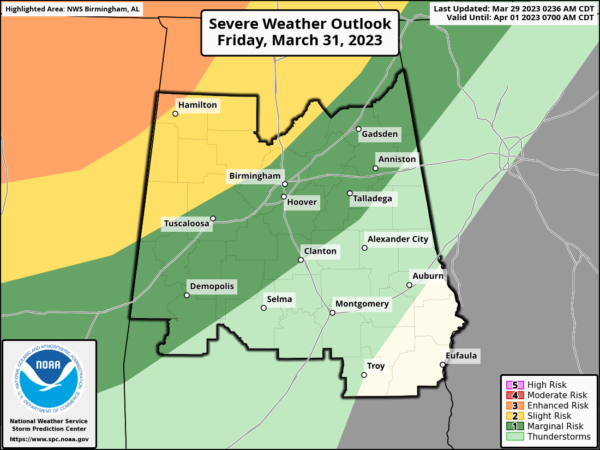
For now, the timing for severe storms will come from 9PM Friday night through 7AM Saturday; another overnight event, everyone will need to have a reliable way of hearing severe weather warnings. All types of severe weather will be possible, including hail, damaging winds, and a few tornadoes. The highest tornado threat will be in areas north and west of Birmingham.
WEEKEND WEATHER: The storms push south Saturday morning, and the day will feature a clearing sky and highs in the upper 70s and lower 80s. Rain and storms Saturday afternoon will be confined to South Alabama. On Sunday, dry air settles into the state and we are forecasting a mostly sunny sky highs will be in the 70s and 80s.
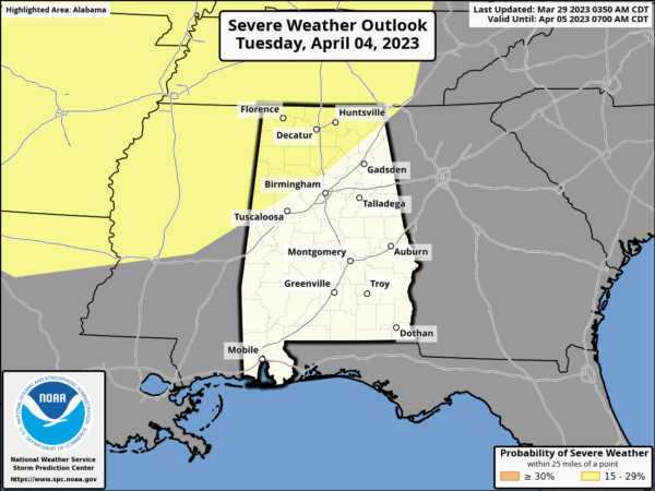
NEXT WEEK: Moisture begins to return Monday, and much of the week looks unsettled with the potential for multiple rounds for rain and storms. A vigorous storm system will bring the risk of severe thunderstorms to the Deep South sometime in the Tuesday/Wednesday time frame, and the SPC has already issued a severe weather threat for the region; way too early to be specific on this threat. The weather looks dry Thursday and Friday.
BEACH FORECAST CENTER: Get the latest weather and rip current forecasts for the beaches from Fort Morgan to Panama City on our Beach Forecast Center page. There, you can select the forecast of the region that you are interested in visiting.
WORLD TEMPERATURE EXTREMES: Over the last 24 hours, the highest observation outside the U.S. was 111.0F at Matam, Senegal. The lowest observation was -87.9F Concordia, Antarctica.
CONTIGUOUS TEMPERATURE EXTREMES: Over the last 24 hours, the highest observation was 95F at Poinciana, FL. The lowest observation was -18F at Cooperstown, ND.
Category: Alabama's Weather, ALL POSTS
About the Author (Author Profile)
Macon, Georgia Television Chief Meteorologist, Birmingham native, and long time Contributor on AlabamaWX. Stormchaser. I did not choose Weather, it chose Me. College Football Fanatic. @Ryan_StinnetSubscribe
If you enjoyed this article, subscribe to receive more just like it.


