Midday Nowcast: Very Warm Day
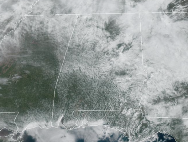
We are seeing a mix of sun and clouds today and temperatures are surging into the mid and upper 80s statewide, there may even be a few spots hit 90° this afternoon. A few isolated afternoon showers or storms are possible, but mainly east of Interstate 65. Expect more of the same tomorrow, but the chance for rain and storms will be west of Interstate 65.
ACROSS THE USA: Severe thunderstorms are expected through tonight from eastern portions of the Plains into the Missouri and mid Mississippi Valleys. Strong, potentially long track tornadoes are possible along with large hail and damaging winds, some of which may occur overnight. These areas are included in “moderate risk” (level 4/5) of severe storms today. Elsewhere, a blizzard is forecast for the northern Plains with extremely critical fire weather conditions over the southern Plains.
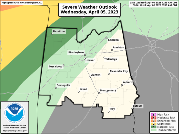
STORMS RETURN: The SPC has defined a “marginal risk” (level 1/5) north of a line from Reform to Smith Lake to Huntsville.
While the upper dynamic support will be lifting far north of Alabama, a few storms Wednesday night could produce strong gusty winds. The tornado threat is very low. The front will drift into Central Alabama and stall out Thursday. Periods of rain will continue through the day Thursday, and there will be a big temperature contrast with highs in the 60s for North Alabama, 70s for the central counties, and 80s for South Alabama.
FRIDAY AND THE EASTER WEEKEND: The front remains stalled, and occasional rain is likely Friday with the wide temperature range continuing. The front gets a southward push late Saturday; we will keep a chance of rain going for the morning hours, but by afternoon the northern counties of the state should be dry. Sunday looks to feature ample sunshine with highs in the 70s.
NEXT WEEK: An upper-ridge looks to build in along the Gulf Coast, and that will keep our weather very warm and mainly dry. Most days will feature more sun than clouds with highs in the 80s.
BEACH FORECAST CENTER: Get the latest weather and rip current forecasts for the beaches from Fort Morgan to Panama City on our Beach Forecast Center page. There, you can select the forecast of the region that you are interested in visiting.
WORLD TEMPERATURE EXTREMES: Over the last 24 hours, the highest observation outside the U.S. was 109.2F at Matam, Senegal. The lowest observation was -68.8F Vostok, Antarctica.
CONTIGUOUS TEMPERATURE EXTREMES: Over the last 24 hours, the highest observation was 102F at Faith Ranch Airport, TX. The lowest observation was 0F at Walker, CA.
Category: Alabama's Weather, ALL POSTS
About the Author (Author Profile)
Macon, Georgia Television Chief Meteorologist, Birmingham native, and long time Contributor on AlabamaWX. Stormchaser. I did not choose Weather, it chose Me. College Football Fanatic. @Ryan_StinnetSubscribe
If you enjoyed this article, subscribe to receive more just like it.


