Saturday Weather Briefing — Rain & Storms Return by the Afternoon Hours
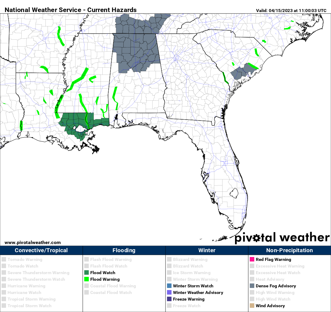
We are starting off today with dense fog across the northern half of the state, and a Dense Fog Advisory is in effect until 9 am. Once the fog lifts, clouds will be on the increase as a cold front will eventually move in later tonight. Showers and storms will become possible over the western parts by this afternoon, with rain and storms likely by tonight. While a strong storm or two are possible, odds for severe weather is very low. Highs in the lower to mid 80s.
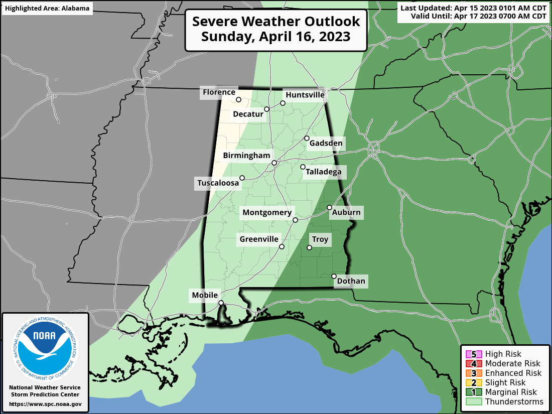
The front will be exiting the area on Sunday that will end the rain chances for Central Alabama. Behind the front, we’ll have cooler and drier air moving in. There is a Marginal Risk up for the southeastern parts of the area during the morning and into the early afternoon hours until the front moves out. Damaging wind gusts and large hail look to be the main threats, but the better dynamics will be far off to the north and will limit those threats. Highs in the mid 60s to the upper 70s.
We’ll have a stretch of very nice weather for the first half of the work week. Monday will be sunny and mild with a little breeze and highs in the lower 70s. Winds become more southerly on Tuesday, which will push highs up into the upper 70s to the lower 80s. Clouds will increase on Wednesday as a short wave will move through the area. However, it will be moisture-starved and we’ll remain dry. Highs in the lower to mid 80s. Troughing will send a few impulses across the southeast that will bring a chance of a few showers to Central Alabama on Thursday, especially during the afternoon and evening hours. Highs in the lower to mid 80s.
And at the end of the forecast period on Friday… A surface low develops just inland of the Gulf Coast that will bring an increase of rain chances to the extreme southern parts of the area, while the rest of Central Alabama will continue to have a small chance of showers. Highs in the mid to upper 80s for most.
Category: Alabama's Weather, ALL POSTS, Severe Weather, Weather Xtreme Videos
About the Author (Author Profile)
Scott Martin is an operational meteorologist, professional graphic artist, musician, husband, and father. Not only is Scott a member of the National Weather Association, but he is also the Central Alabama Chapter of the NWA president. Scott is also the co-founder of Racecast Weather, which provides forecasts for many racing series across the USA. He also supplies forecasts for the BassMaster Elite Series events including the BassMaster Classic.Subscribe
If you enjoyed this article, subscribe to receive more just like it.


