Severe Thunderstorm Watches to our West, but Storms Will Weaken Overnight
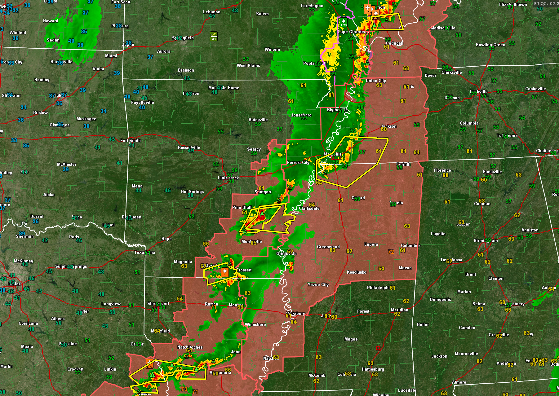
Severe thunderstorm watches extend from Central Illinois to the Middle Texas Coast tonight, including all of northern and western Mississippi.
A line of strong thunderstorms extends from near Effingham IL, to Cape Girardeau MO, to the east of Memphis, to Eldorado AR, to near Alexandria LA, to near Beaumont TX.
Severe thunderstorm warnings are in effect for areas east of Memphis, southeast of Pine Bluff AR, areas west of Alexandria LA, and in the Beaumont/Arthur area.
The storms are moving east at 35 mph.
Damaging winds will impact southern Tennessee and northern Mississippi over the next couple of hours. These storms are expected to fall apart though before they reach Alabama. In fact, they will completely dissipate before morning. A few showers will accompany the frontal system as it crosses North and Central Alabama during the morning hours, but they will be over by noon.
It looks like the front will make it well into Georgia before the severe weather threat ramps back up tomorrow afternoon, so the severe weather will in effect “skip” over Alabama. That’s great news.
Skies will be slow to clear from the northwest tomorrow, but will completely clear tomorrow night with lows in the 40s. Monday will be breezy and cool with highs in the lower 70s.
A big warm-up will progress through midweek. Rain and storms won’t return til late Thursday.
Category: Alabama's Weather, ALL POSTS, Severe Weather
About the Author (Author Profile)
Bill Murray is the President of The Weather Factory. He is the site's official weather historian and a weekend forecaster. He also anchors the site's severe weather coverage. Bill Murray is the proud holder of National Weather Association Digital Seal #0001 @wxhistorianSubscribe
If you enjoyed this article, subscribe to receive more just like it.


