Alabama Weather Update: 11:35 a.m.
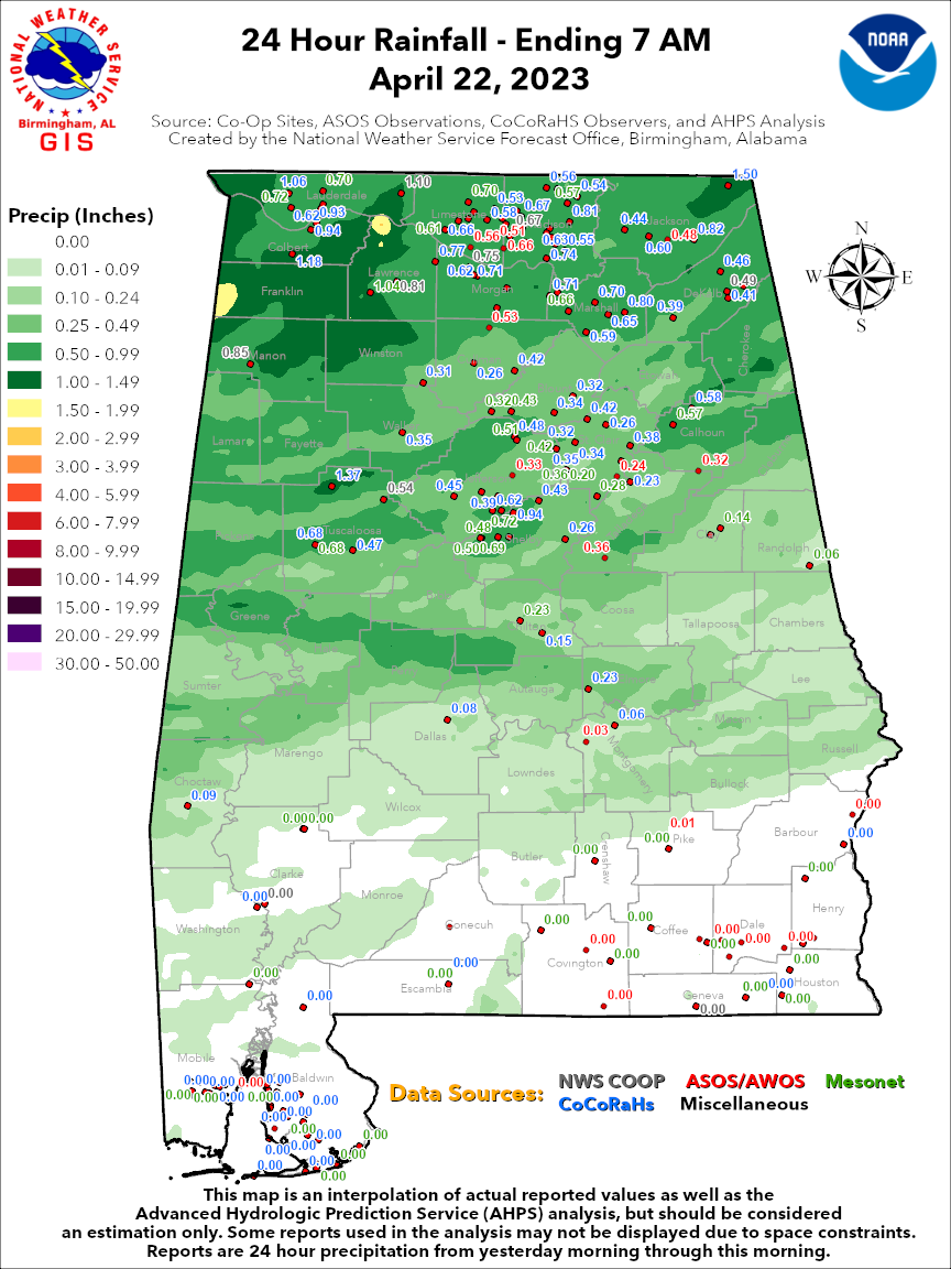
All of the leftover showers from last night’s cold front are out of Alabama as of about 10:30 a.m. Here are rainfall amounts from yesterday through early this morning:
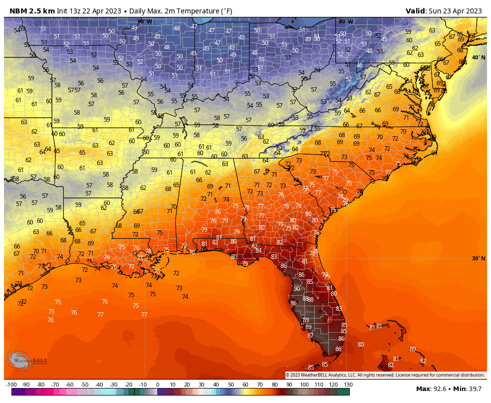
Here is the current satellite and radar along with temperatures:
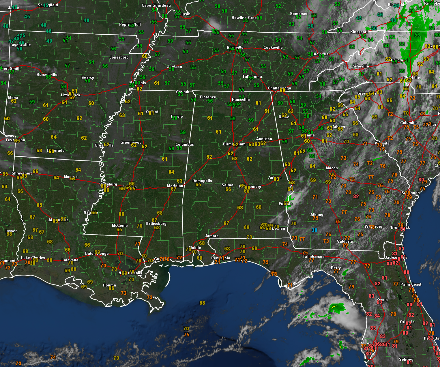
Clouds are exiting the southeastern part of the state, but some clouds over Mississippi will move across Alabama later today, and clouds are thickening to the west over Oklahoma and Texas. We will deal with those tomorrow.
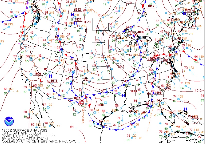
Northerly winds have now engulfed the entire state behind that front, which has pushed as far southeast as beautiful Cape San Blas in the Florida Panhandle. A second cold front is on its way, located now over the Missouri Bootheel, is headed our way. It will reach Central Alabama tonight, and fizzle out there, so no real effects on our weather except to drop temperatures a couple of degrees.
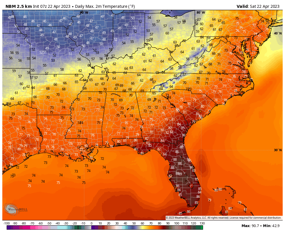
Temperatures this afternoon will rise into the 60s Northwest and 70s elsewhere.
Lows tonight will be in the 40s.
Sunday highs will be a little cooler behind the second front. Great weather for Talladega tomorrow. And today!
A passing shortwave tomorrow will increase our clouds and bring a slight chance of showers Sunday night. Amounts will be light and spotty.
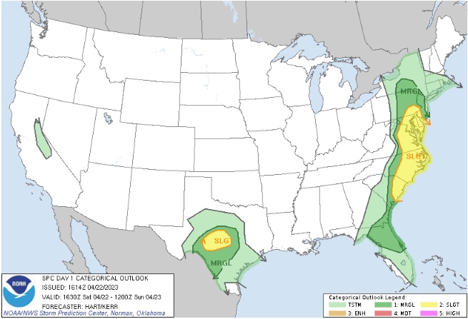
Nationally, freeze warnings are the big story in the nation’s midsection, including parts of Nebraska, Kansas, Missouri, Iowa, and Illinois. Severe weather is occurring in the Mid-Atlantic with severe thunderstorm watches in effect. Severe weather is also possible later today in the Texas Hill Country.
Don’t miss the middle eastern food festival today over at St. Elias in Birmingham’s historic Glen Iris neighborhood. It is one of Birmingham;s annual treats!
Category: ALL POSTS
About the Author (Author Profile)
Bill Murray is the President of The Weather Factory. He is the site's official weather historian and a weekend forecaster. He also anchors the site's severe weather coverage. Bill Murray is the proud holder of National Weather Association Digital Seal #0001 @wxhistorianSubscribe
If you enjoyed this article, subscribe to receive more just like it.


