Anatomy of a Friday Night Spin Up
A possible brief, weak tornado apparently spun up in Fayette County Friday evening just after 7:30 p.m.
Large tree limbs and a few uprooted trees were reported down by the Fayette County Emergency Manager at about 7:35 p.m., but fortunately, we had no reports of property damage or injury.
The possible tornado occurred near the comma head of a mesoscale convective vortex that was pushing east-northeastward from eastern Mississippi. The vertex moved through Belk and Fayette with broad rotation just after 7 p.m.
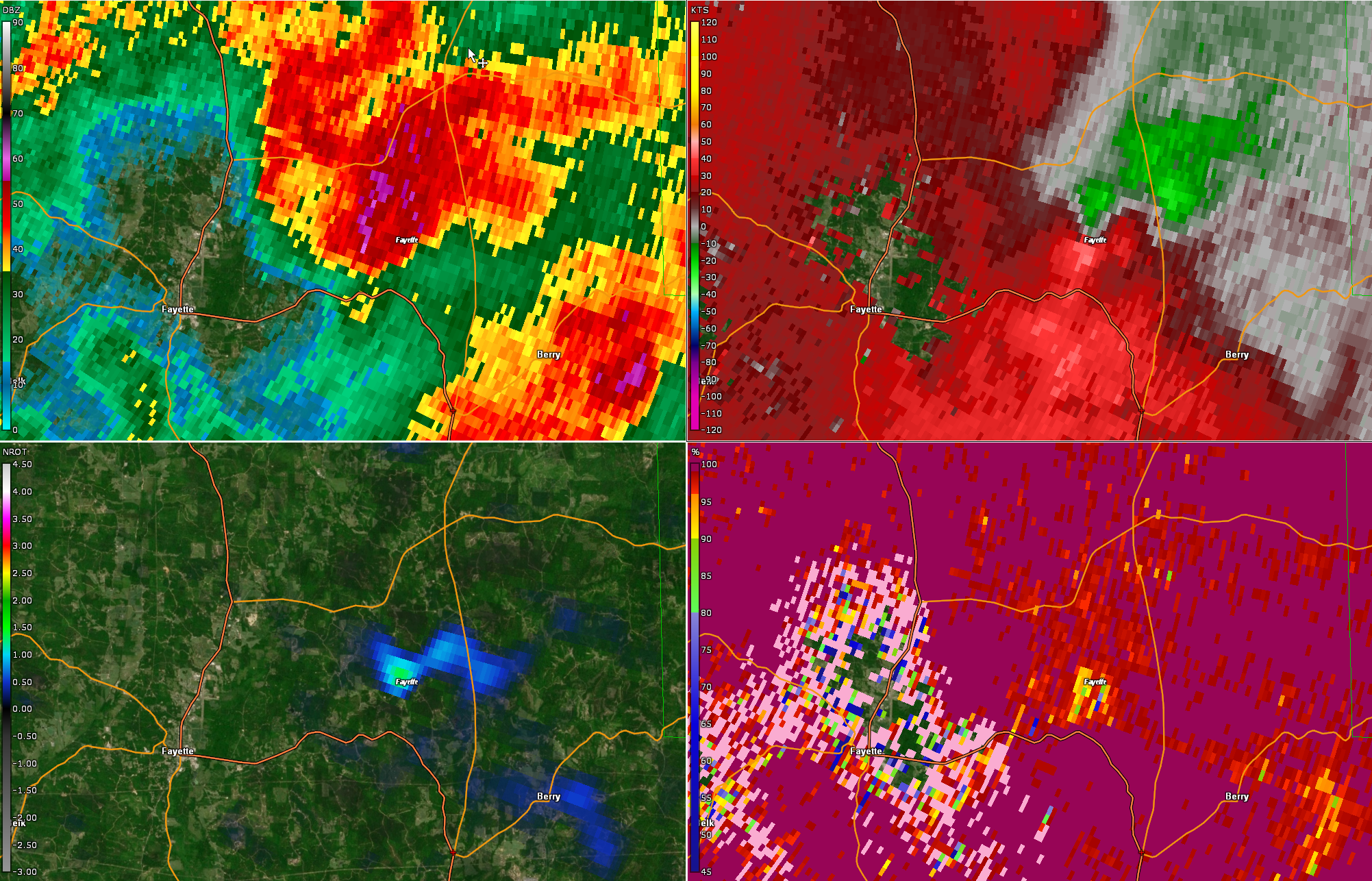
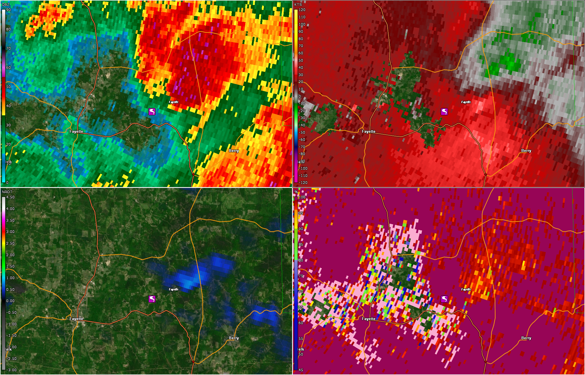
Here are radar images from the NEXRAD at Greenwood Springs (Columbus) MS. Base reflectivity is in the top left window, storm relative velocity is in the top right window, correlation coefficient, which shows debris, is in the bottom right, and normalized rotation is in the bottom left. When the normalized rotation product reaches 1, shown in green, concern for a tornado begins.
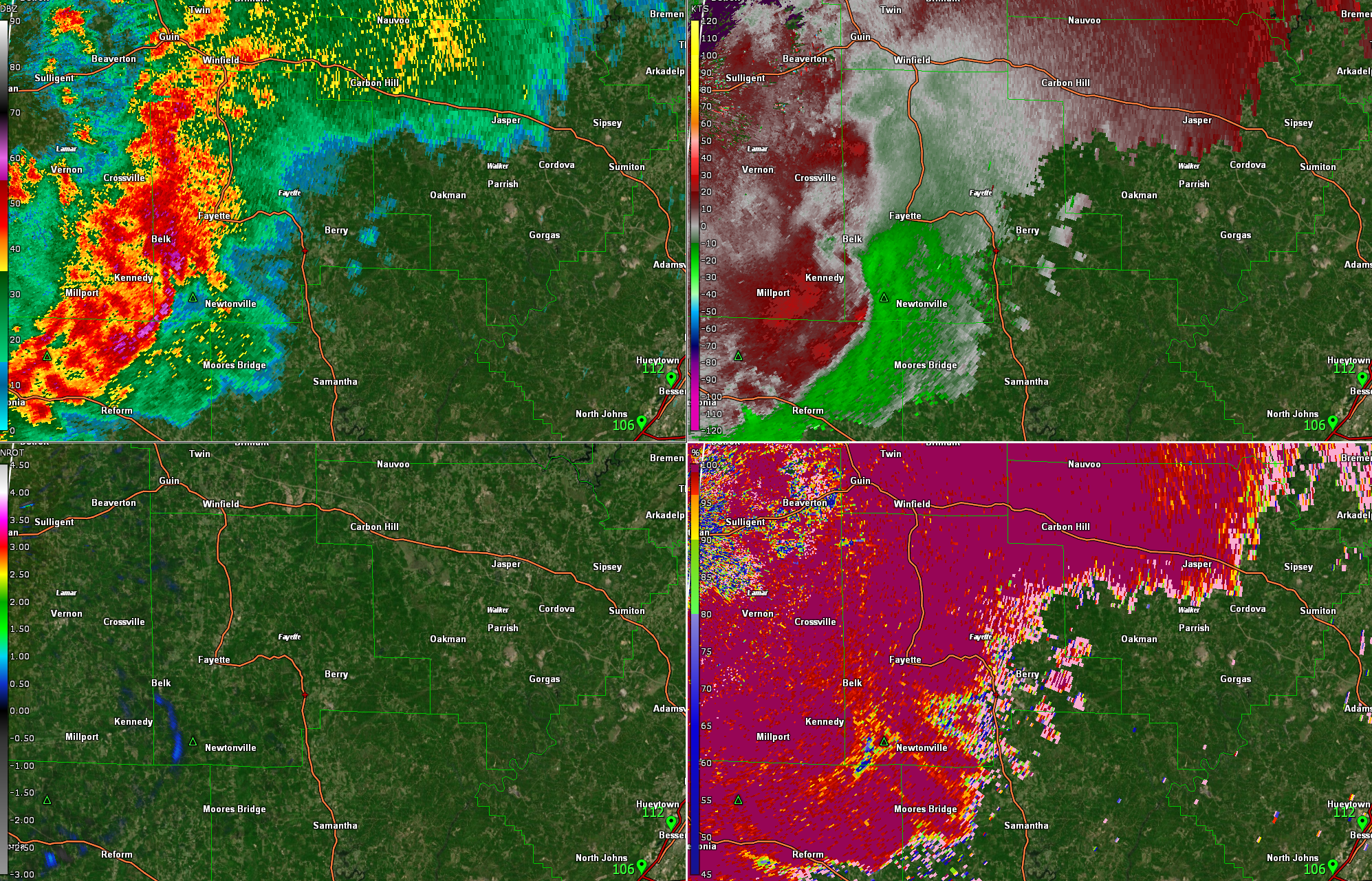
That rotation began to increase and tighten as it exited the City of Fayette along US-43 near the community of Stough. This coincided with a storm split that saw the vertex separate itself from the line of storms. There definitely was increased bulk (speed) shear that was located in the area west of Birmingham.
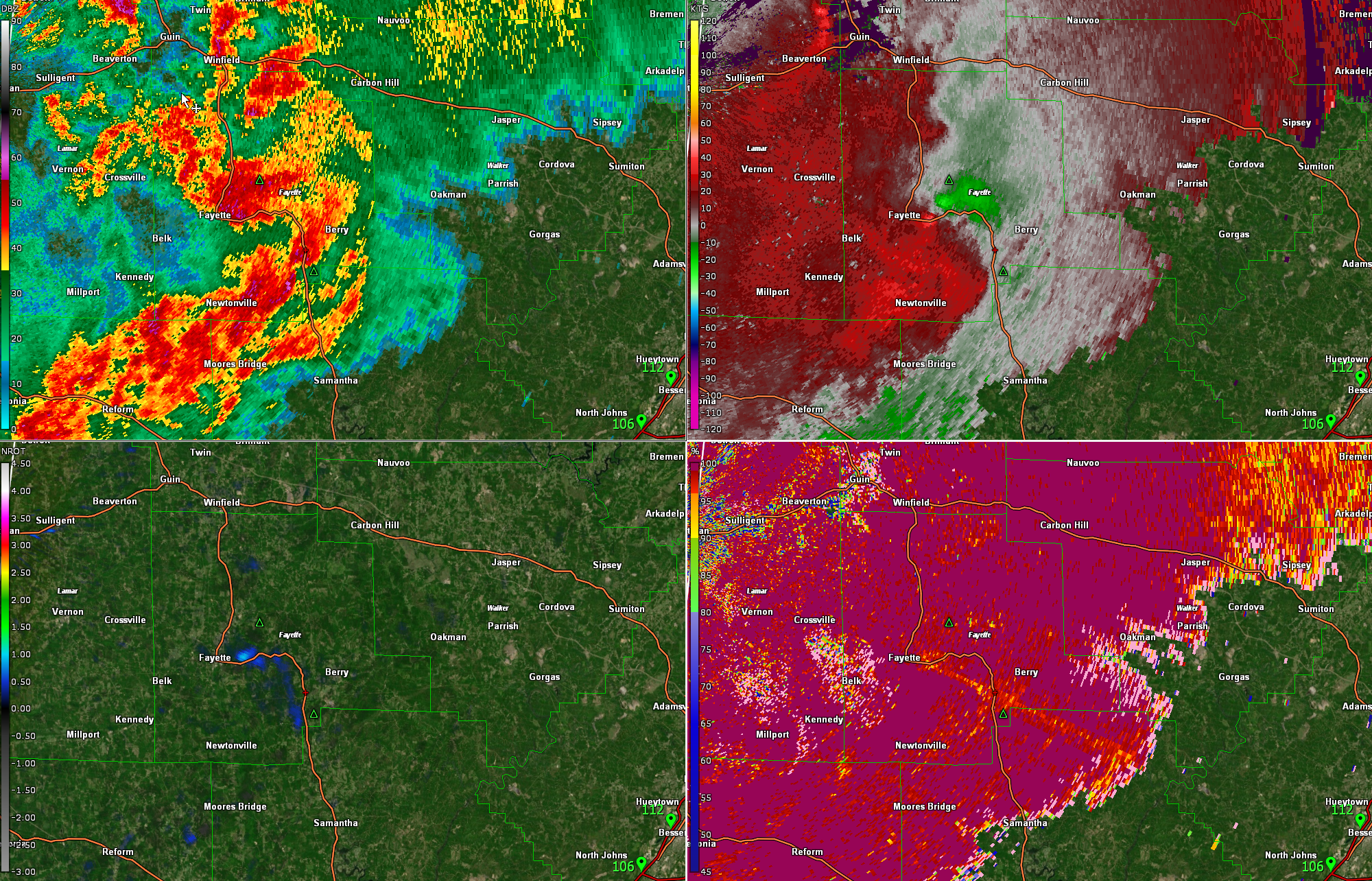
The rotation reached its maximum around 7:35 p.m. CDT about 6 miles northwest of Bankston.
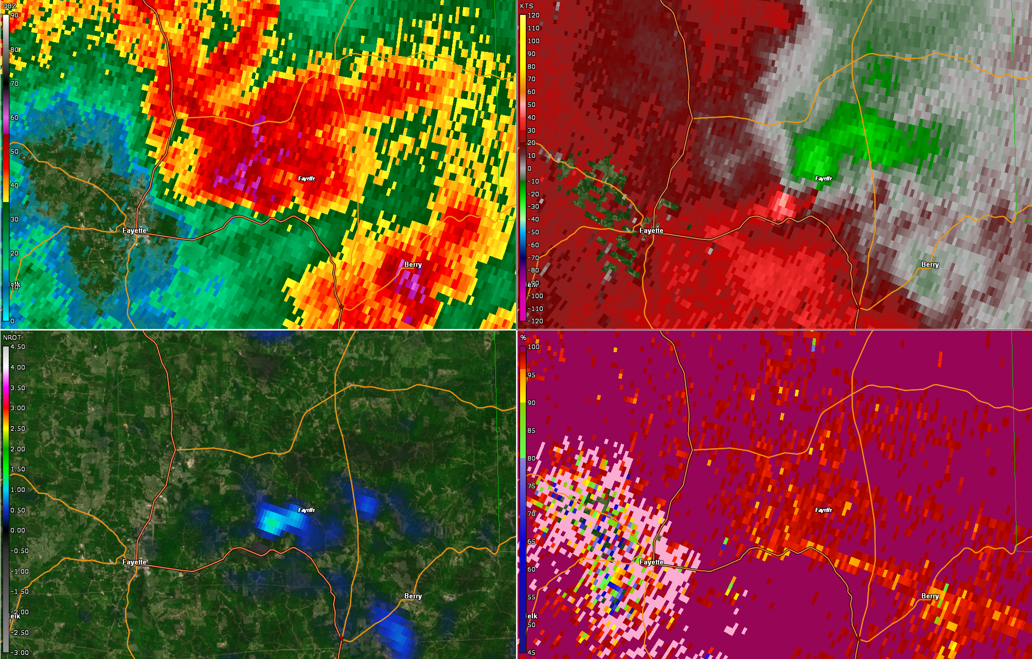
A debris signature may have appeared on the Correlation Coefficient product in the scan at 7:37 p.m., indicating a possible tornado touchdown.
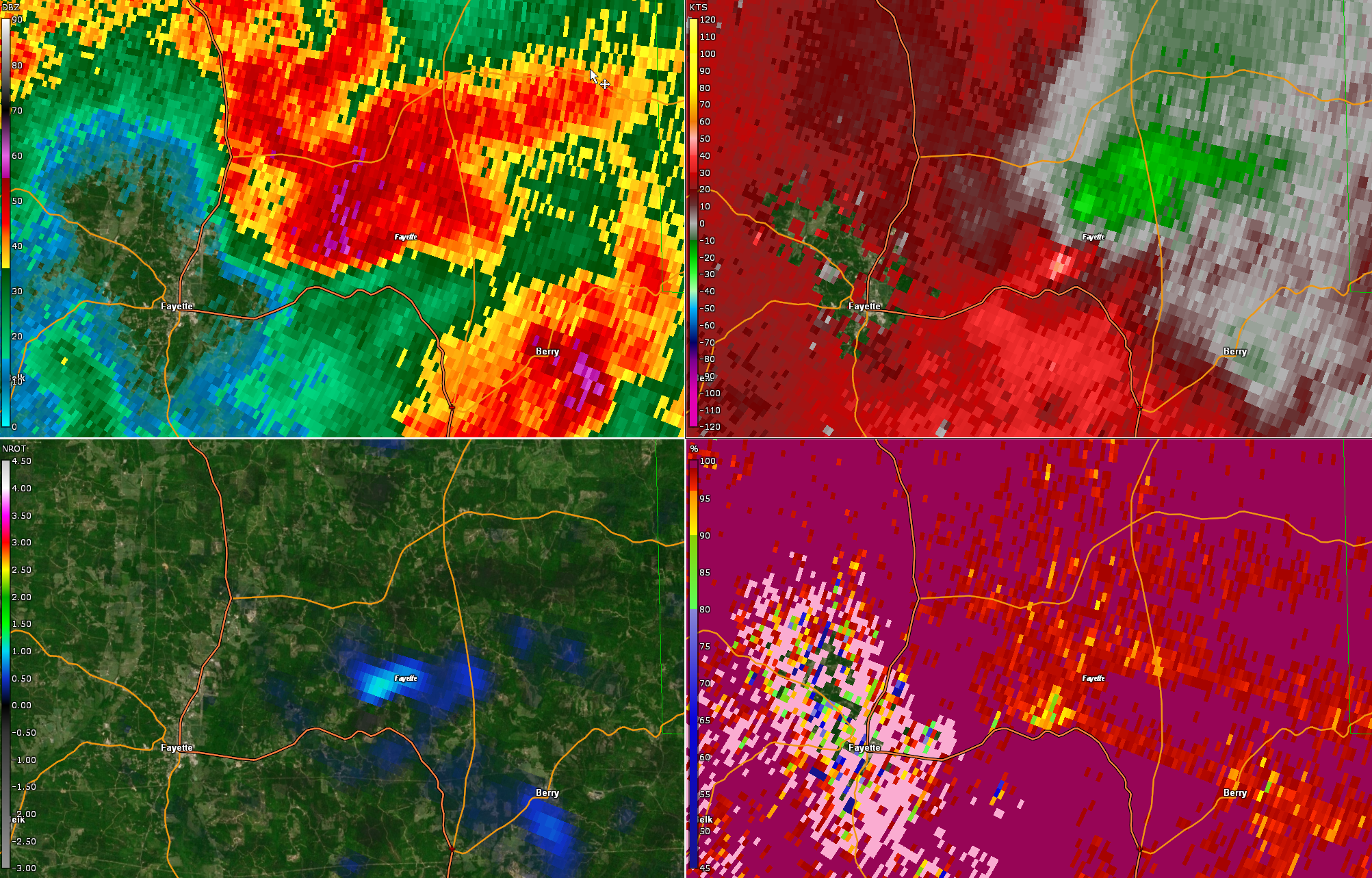
The rotation was at its max at about 7:39 p.m. while it was a couple of miles north of US-43.
The rotation weakened over the next two volume scans as the couplet approached AL-13 7 miles north of Bankston at 7:42 p.m.
According to Gary Goggins at the NWS Birmingham, they will survey the damage once more information is ascertained.
No watches or warnings were in effect when the spin-up occurred. Conditions were just not that favorable for severe storms, and especially not for tornadoes. The NWS in Birmingham did have a significant weather advisory in effect for the area up until 7:30 p.m.
But we often see storms give a little kick from the increasingly hilly terrain over West Central Alabama.
Just another example of when it comes to thunderstorms in Alabama, especially in the spring, expect the unexpected.
Category: Alabama's Weather, ALL POSTS, Severe Weather
About the Author (Author Profile)
Bill Murray is the President of The Weather Factory. He is the site's official weather historian and a weekend forecaster. He also anchors the site's severe weather coverage. Bill Murray is the proud holder of National Weather Association Digital Seal #0001 @wxhistorianSubscribe
If you enjoyed this article, subscribe to receive more just like it.


