Midday Nowcast: Nice, Spring Day
After the chilly start to the day, we are seeing a nice warm-up this afternoon with many locations heading into the low and mid 70s. We are seeing a mix of sun and clouds today, and mainly dry conditions, but we cannot completely rule out a stray sprinkle or two later this afternoon or tonight. It will not be as chilly tonight with lows in the low to mid 50s.
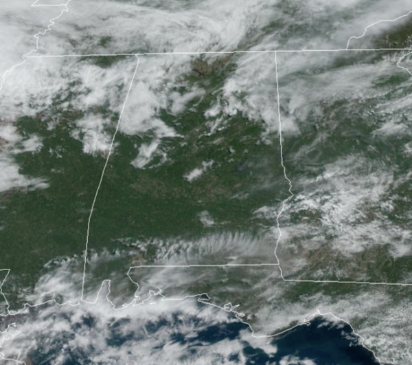
SHOWERS RETURNS: Moisture levels will be on the rise tomorrow and we will see increasing clouds with scattered areas of rain returning. It won’t rain all day and everywhere, but just know that passing rain will be possible at anytime. Highs tomorrow will be in the 70s.
STORMY THURSDAY: A wave of energy will bring more widespread rain and thunderstorms back to Alabama Thursday. We thought this could happen, the SPC has introduced a low end, “marginal risk” of severe thunderstorms for the southern 3/4 of the state, for areas south of a line from Hamilton to Cullman to Gadsden as instability values will be increasing.
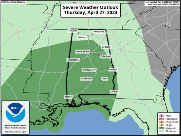
Expect highs again in the 70s. Good news, the better dynamics with this system will be well north of Alabama, but still a few stronger storms could produce small hail and gusty winds, with a low but not zero threat of an isolated tornado. Better chance for the stronger storms will come during the late morning and afternoon hours.
FRIDAY AND THE WEEKEND: Friday will feature more clouds than sun, and the chance for a few scattered showers across Alabama. Highs will remain the 70s. For now, most of Saturday is now looking dry with highs in the 70s, and the models suggest the next wave of energy will not arrive until late Saturday. As the feature approaches, another round of widespread rain moves into the state Saturday night, lasting into part of the day Sunday. For now, severe storms are not expected with very little surface based instability available, but again, this could change in the coming days and we will monitor trends. Clouds will linger through the day Sunday with highs ranging from the upper 60s to lower 70s, which are about ten degrees below average for the end of April.
NEXT WEEK: For now it looks like the primary chance of rain during the week will come late Tuesday, Tuesday night, into part of the day Wednesday. Highs will be mostly in the 70s Monday and Tuesday, with low 80s possible over the latter half of the week.
BEACH FORECAST CENTER: Get the latest weather and rip current forecasts for the beaches from Fort Morgan to Panama City on our Beach Forecast Center page. There, you can select the forecast of the region that you are interested in visiting.
WORLD TEMPERATURE EXTREMES: Over the last 24 hours, the highest observation outside the U.S. was 114.1F at Matam, Senegal. The lowest observation was -94.0F Concordia, Antarctica.
CONTIGUOUS TEMPERATURE EXTREMES: Over the last 24 hours, the highest observation was 101F Death Valley, CA. The lowest observation was 7F at Peter Sinks, UT.
Category: Alabama's Weather, ALL POSTS
About the Author (Author Profile)
Macon, Georgia Television Chief Meteorologist, Birmingham native, and long time Contributor on AlabamaWX. Stormchaser. I did not choose Weather, it chose Me. College Football Fanatic. @Ryan_StinnetSubscribe
If you enjoyed this article, subscribe to receive more just like it.


