Midday Nowcast: Scattered Rain and Storms Ahead
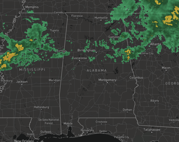
Scattered areas of rain have been ongoing this morning, but most of these have pushed into Georgia. Through the afternoon, additional rain and storms will be possible and we note SPC has maintains a very low end, “marginal risk” of severe thunderstorms for parts of Central and South Alabama this afternoon; a few storms could produce small hail and gusty winds. No tornado threat today.
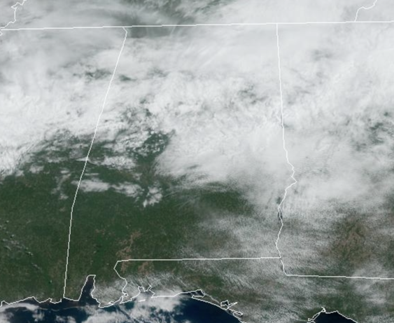
Temperatures are ranging from the upper 60s to lower 70s under a mostly cloudy sky.
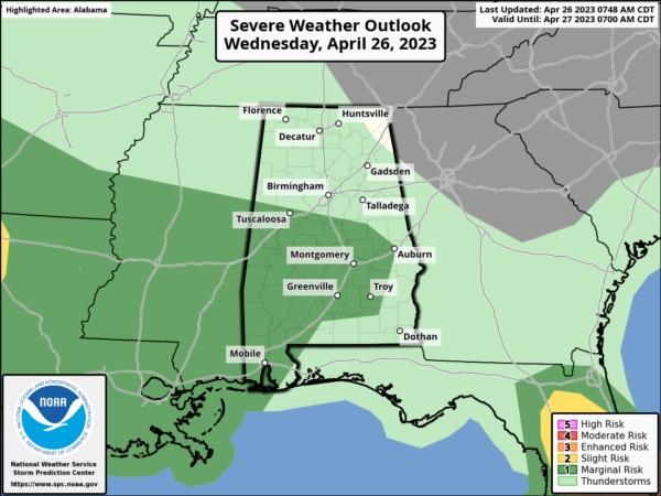
MORE STORMS TOMORROW: A wave of energy will bring more widespread rain and thunderstorms back to Alabama tomorrow and the SPC has defined a “slight risk” (level 2/5) of severe thunderstorms for South Alabama…for areas south of a line from Grove Hill to Greenville to Eufaula. A “marginal risk” (level 1/5) extends as far north as Decatur and Huntsville.
The main threat of stronger storms will be over the southern quarter of the state, where the air will be most unstable. The main threats will come from small hail and strong straight line winds, but an isolated tornado can’t be ruled out. The risk of severe thunderstorms over the northern half of the state is low. Rain amounts over North Alabama will be generally 1/2 inch or less. The main window for rain tomorrow will come from 10AM-5PM; any lingering showers tomorrow night should be few and far between.
FRIDAY AND THE WEEKEND: Friday will feature more clouds than sun, and the chance for a few scattered showers across Alabama. Highs will remain the 70s. For now, we continue to go with a mostly dry Saturday with highs in the 70s. Another round of widespread rain move into the state Saturday night, lasting into part of the day Sunday. For now, severe storms are not expected with very little surface based instability available, but again, this could change in the coming days and we will monitor trends. Clouds will linger through the day Sunday with highs ranging from the upper 60s to lower 70s, which are about ten degrees below average for the end of April.
NEXT WEEK: For now most of next week is dry. Temperatures will begin to moderate through the week with highs in the 70s Monday and Tuesday, with low 80s possible over the latter half of the week.
BEACH FORECAST CENTER: Get the latest weather and rip current forecasts for the beaches from Fort Morgan to Panama City on our Beach Forecast Center page. There, you can select the forecast of the region that you are interested in visiting.
WORLD TEMPERATURE EXTREMES: Over the last 24 hours, the highest observation outside the U.S. was 114.8F at N’Guigmi, Niger. The lowest observation was -93.5F Vostok, Antarctica.
CONTIGUOUS TEMPERATURE EXTREMES: Over the last 24 hours, the highest observation was 98F Death Valley and Palm Springs, CA. The lowest observation was 0F at Peter Sinks, UT.
Category: Alabama's Weather, ALL POSTS
About the Author (Author Profile)
Macon, Georgia Television Chief Meteorologist, Birmingham native, and long time Contributor on AlabamaWX. Stormchaser. I did not choose Weather, it chose Me. College Football Fanatic. @Ryan_StinnetSubscribe
If you enjoyed this article, subscribe to receive more just like it.


