Threat of Large Hail & Damaging Winds Starting to Increase for Extreme Western AL & to Our West
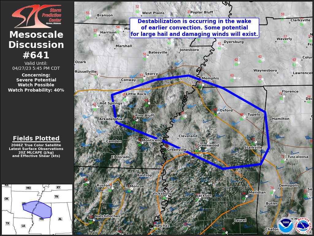
We are starting to see some destabilization of the atmosphere in Northern Mississippi and into the extreme western portions of North/Central Alabama. With this destabilization increasing, the threat for storms with isolated damaging wind gusts and large hail up to and exceeding quarter size in diameter. Here is the text from Mesoscale Discussion #641:
SUMMARY… A few storms may develop near the shortwave trough in Arkansas and ahead of the cold front in Mississippi. Large hail and isolated damaging winds are the primary threats. A watch may be needed should convective trends warrant.
DISCUSSION… Objective mesoanalysis shows increasing boundary-layer destabilization from east-central Arkansas into northern Mississippi. As clouds have dissipated through the day, low-levels have recovered to some degree. Visible satellite indicates increasing cumulus across central Mississippi. Closer to the upper-level trough in Arkansas, additional convection has also recently developed. Shear should increase as the upper trough moves east. Effective shear of 45-60 kts will favor organized storms. Long hodographs and cold mid-level temperatures (around -14 to -17 C) suggest large hail potential. Damaging wind gusts may also occur, but low-level lapse rates should keep that threat more isolated. The highest confidence in storm development/persistence will be near the shortwave trough. It is less certain how many storms will form in central/northern Mississippi, but those storms would have more potential for large hail. Trends will be monitored for a possible watch.
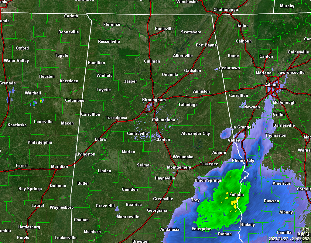
For now, the only rain activity in the area is over the extreme southeastern parts, including Troy, Eufaula, Phenix City, and Smiths Station. However, as a short wave approaches the area, scattered showers and storms are expected to form to our west and move over the northwestern quarter of the state. Any one of those will have the potential for large hail and isolated damaging wind gusts. Tornadoes are not expected as the winds will be uniform in direction.
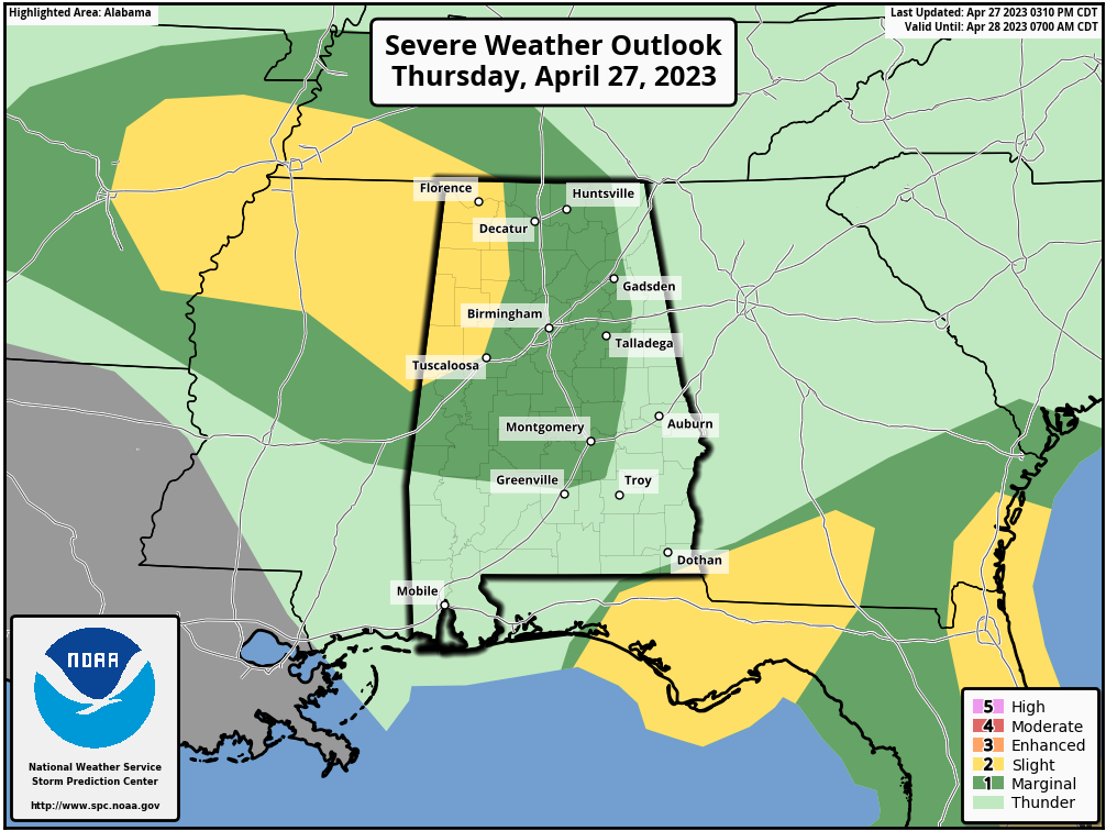
A Slight Risk for severe storms continues along and west of a line from Lexington (Lauderdale Co.) to Oakman (Walker Co.) to Northport (Tuscaloosa Co.) to just north of Geiger (Sumter Co.). A Marginal Risk is up east and south of the slight risk to Scottsboro (Jackson Co.) to Anniston (Calhoun Co.) to Fort Deposit (Lowndes Co.)
Category: Alabama's Weather, ALL POSTS, Severe Weather
About the Author (Author Profile)
Scott Martin is an operational meteorologist, professional graphic artist, musician, husband, and father. Not only is Scott a member of the National Weather Association, but he is also the Central Alabama Chapter of the NWA president. Scott is also the co-founder of Racecast Weather, which provides forecasts for many racing series across the USA. He also supplies forecasts for the BassMaster Elite Series events including the BassMaster Classic.Subscribe
If you enjoyed this article, subscribe to receive more just like it.


