Severe T-Storm Watch Issued for Portions of Central Alabama Until 11 pm
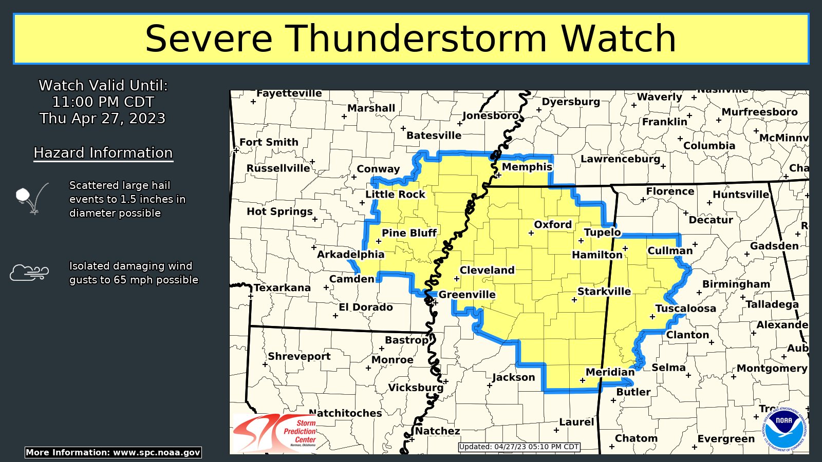
The SPC and NWS Birmingham have issued a SEVERE THUNDERSTORM WATCH until 11 pm tonight for the following counties in Central Alabama: Fayette, Greene, Lamar, Marion, Pickens, Sumter, Tuscaloosa, Walker, and Winston.
• Scattered large hail events to 1.5 inches in diameter possible
• Isolated damaging wind gusts to 65mph possible
The NWS Storm Prediction Center has issued a
* Severe Thunderstorm Watch for portions of
Western Alabama
Eastern Arkansas
Northern and central Mississippi
Far southwest Tennessee
* Effective this Thursday afternoon and evening from 515 PM until
1100 PM CDT.
* Primary threats include…
Scattered large hail events to 1.5 inches in diameter possible
Isolated damaging wind gusts to 65 mph possible
SUMMARY…A few lower-topped supercells should develop and spread
east across a portion of the Mid to Deep South. Large hail sizes
from quarters to golf balls should be the main threat.
Category: Alabama's Weather, ALL POSTS, Severe Weather
About the Author (Author Profile)
Scott Martin is an operational meteorologist, professional graphic artist, musician, husband, and father. Not only is Scott a member of the National Weather Association, but he is also the Central Alabama Chapter of the NWA president. Scott is also the co-founder of Racecast Weather, which provides forecasts for many racing series across the USA. He also supplies forecasts for the BassMaster Elite Series events including the BassMaster Classic.Subscribe
If you enjoyed this article, subscribe to receive more just like it.


