Radar Check at 1 a.m.
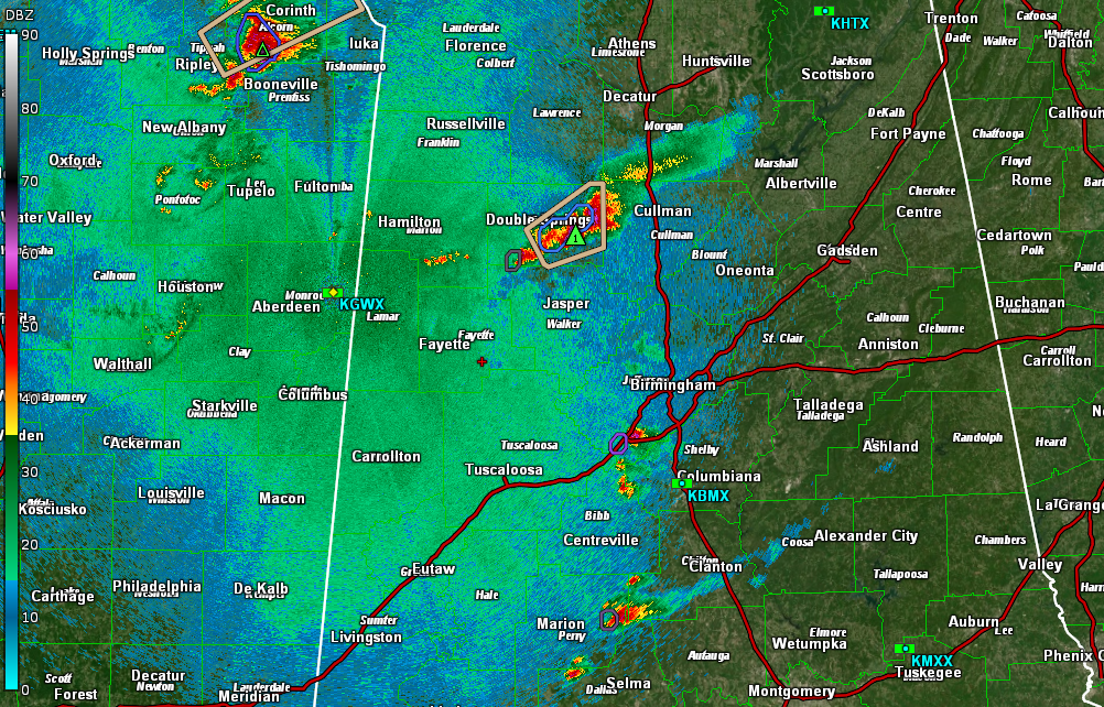
We have one strong storm in the state at this hour. It is over eastern Winston County, near Double Springs. This storm has a good bit of lightning in it. There could be some small hail in addition as well as heavy rain. Winds could gust to 40 mph as well.
A trio of showers entering southwestern Jefferson County from Bibb County seems to be holding together, bringing a brief spate of heavy rain and gusty winds.
The storms in Mississippi have weakened, with the exception of the storm that is approaching Corinth. This storm will head up into southern Tennessee, perhaps only clipping the far northwestern corner of Lauderdale County.
In the Birmingham area, a few showers extend from northwestern Jefferson County to the west of Graysville and Adamsville. These are leftover remnants of earlier storms. They may dissipate soon.
There are storms in eastern Perry and western Dallas County. These storms will move into Chilton County and pass near Clanton and will clip the northwestern corner of Autauga County. These storms seem to be running out of steam.
Category: Alabama's Weather, ALL POSTS, Severe Weather
About the Author (Author Profile)
Bill Murray is the President of The Weather Factory. He is the site's official weather historian and a weekend forecaster. He also anchors the site's severe weather coverage. Bill Murray is the proud holder of National Weather Association Digital Seal #0001 @wxhistorianSubscribe
If you enjoyed this article, subscribe to receive more just like it.


