

Midday Nowcast: Sun, Clouds, Some Showers
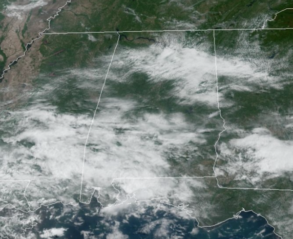
We are seeing a mix of sun and clouds again today, with warm and muggy conditions. Temperatures this afternoon are in the mid to upper 80s. Scanning the radar, a few afternoon showers are out there, these are widely scattered, and most locations will remain dry.
ACROSS THE USA: Severe thunderstorms with large hail, damaging winds, and tornadoes will impact eastern North Carolina and the south-central Plains Tuesday, and the central High Plains on Wednesday and Thursday. Excessive rain may lead to flash flooding over southeast Texas and into the ARKLATEX Tuesday and Wednesday, over the northern High Plains on Thursday, and central Texas on Friday.
SUMMER-LIKE PATTERN CONTINUES: Little change in the day to day forecast the rest of this week as the pattern has become fairly stagnant. Warm, humid days with widely scatted and random, showers and storms daily. The best chance of seeing a shower is during the afternoon and evening hours. Afternoon highs will mainly be in the mid to upper 80s, but certainly a few low 90s will show up on the maps across South and Southwest Alabama. Daily rain chances this week are in the 20-40 percent range.
WEEKEND WEATHER: The upper ridge strengthens and heat levels will be on the increase with afternoon highs around 90 more and more common. Both days, expect a mix of sun and clouds with a small risk of a shower for any one given location, generally less than 20%. It will be the hottest weekend so far in 2023.
INTO NEXT WEEK: The pattern holds into at least the early part of next week with warm, humid days and scattered showers and storms around each afternoon. Highs will range from the mid and upper 80s to low 90s.
BEACH FORECAST CENTER: Get the latest weather and rip current forecasts for the beaches from Fort Morgan to Panama City on our Beach Forecast Center page. There, you can select the forecast of the region that you are interested in visiting.
WORLD TEMPERATURE EXTREMES: Over the last 24 hours, the highest observation outside the U.S. was 115.5F at Abadan, Iran. The lowest observation was -99.6F Vostok, Antarctica.
CONTIGUOUS TEMPERATURE EXTREMES: Over the last 24 hours, the highest observation was 106F at Rio Grande Village, TX. The lowest observation was 17F at Peter Sinks, UT.
Category: Alabama's Weather, ALL POSTS
About the Author (Author Profile)
Macon, Georgia Television Chief Meteorologist, Birmingham native, and long time Contributor on AlabamaWX. Stormchaser. I did not choose Weather, it chose Me. College Football Fanatic. @Ryan_StinnetSubscribe
If you enjoyed this article, subscribe to receive more just like it.


