Severe Thunderstorm Warning for Parts of Talladega County Until 1 p.m.
Showers and storms have developed in the I-20 Corridor this afternoon along an outflow boundary that moved down into the state from storms in Tennessee overnight.
Hail and 60 mph winds are possible with the stronger storms.
Conditions do favor additional storm development this afternoon with good instability. Just not much shear. Hail and damaging winds gusts will be the problems.
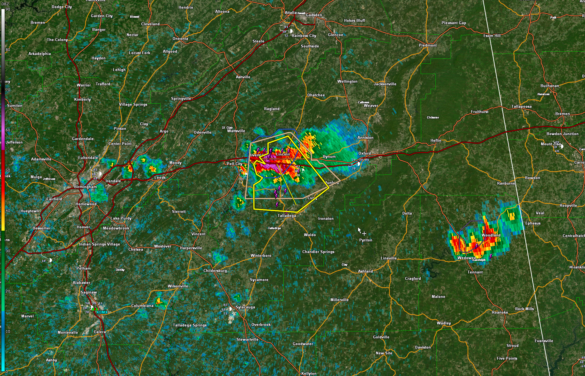
The National Weather Service in Birmingham has issued a
* Severe Thunderstorm Warning for…
North central Talladega County in east central Alabama…
* Until 100 PM CDT.
* At 1217 PM CDT, a severe thunderstorm was located over Lincoln, or
7 miles east of Pell City, moving southeast at 15 mph.
HAZARD…60 mph wind gusts and quarter size hail.
SOURCE…Radar indicated.
IMPACT…Hail damage to vehicles is expected. Expect wind damage
to roofs, siding, and trees.
* Locations impacted include…
Talladega, Lincoln, Munford, Talladega Superspeedway, Honda
Manufacturing Of Alabama, Talladega Municipal Airport, Logan Martin
Lake, Jackson Shoals and Howells Cove.
Category: Alabama's Weather, ALL POSTS, Severe Weather
About the Author (Author Profile)
Bill Murray is the President of The Weather Factory. He is the site's official weather historian and a weekend forecaster. He also anchors the site's severe weather coverage. Bill Murray is the proud holder of National Weather Association Digital Seal #0001 @wxhistorianSubscribe
If you enjoyed this article, subscribe to receive more just like it.


