Heads Up… A Few Isolated Damaging Wind Gusts and Isolated Large Hail Possible this Afternoon
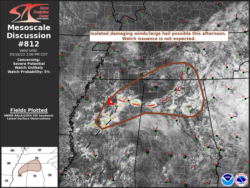
We currently have strong storms across Marion County, with more back off to the west. We are watching for any isolated severe thunderstorm development over the northern parts of the area. The SPC has issues a Mesoscale Discussion for these parts of Central Alabama, and here is the text:
SUMMARY… Isolated strong downburst winds and occasional severe hail
are possible this afternoon. This threat will remain too transient
and localized to warrant watch issuance.
DISCUSSION… Convective initiation is well underway across northern
MS into northern AL in the vicinity of a weak surface low and
attendant weak warm front/differential heating boundary draped to
the east. Latest GOES imagery and lightning trends indicate that
much of this convection is intensifying, likely owing to ample
diurnal warming with temperatures warm through the upper 70s into
the low 80s. Further warming, combined with cool temperatures aloft
in the vicinity of a weak upper low, will support MLCAPE values
upwards of 1500-2000 J/kg by mid-afternoon across northern AL to
southern middle TN. Although deep-layer shear is fairly modest,
favorable thermodynamics (aforementioned buoyancy combined with
PWATs above 1.5 inches and low-level lapse rates near 8 C/km) will
support the potential for damaging downburst winds as storms begin
to cluster and propagate north/northeast. Additionally, sporadic
hail approaching severe limits will be possible with the more
intense updraft pulses, though storm longevity will likely remain
too limited to support a substantial hail threat.
Further south across south-central MS, stronger mid-level flow is
likely supporting effective bulk shear values on the order of 25-30
knots within a similar thermodynamic environment. While this region
is conditionally more favorable for organized severe convection,
confidence in storm coverage remains very limited owing to very
weak/localized forcing for ascent.
Category: Alabama's Weather, ALL POSTS, Severe Weather
About the Author (Author Profile)
Scott Martin is an operational meteorologist, professional graphic artist, musician, husband, and father. Not only is Scott a member of the National Weather Association, but he is also the Central Alabama Chapter of the NWA president. Scott is also the co-founder of Racecast Weather, which provides forecasts for many racing series across the USA. He also supplies forecasts for the BassMaster Elite Series events including the BassMaster Classic.Subscribe
If you enjoyed this article, subscribe to receive more just like it.


