Midday Nowcast: More Afternoon Storms
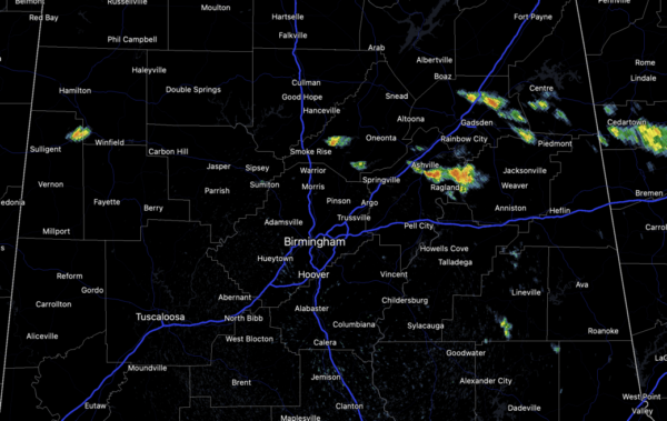
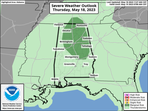
Scattered showers and storms are once again increasing in coverage this afternoon, and as in recent days, some storms could be strong to locally severe with gusty winds and hail. The SPC maintains a “marginal risk” (level 1/5) in place much for many of the northern and central counties this afternoon and evening.
Additionally, storms will be producing very heavy rain and lots of lightning. The storms will gradually wind down late this evening and overnight with the loss of daytime heating. Otherwise, we are seeing more clouds than sun with temperatures in the upper 70s to lower 80s.
FRIDAY: Scattered showers and storms will remain in the forecast tomorrow, but they should be fewer in number with the higher coverage across southern sections of the state. It will be another partly sunny day with afternoon highs in the upper 70s to low 80s. Rain chances tomorrow will be in the 40-50% range.
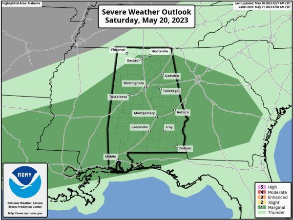
WEEKEND WEATHER: A surface front will pass through the state Saturday, with more numerous showers and storms. The SPC has much of the state in a “marginal risk” (level 1/5) of severe thunderstorms for the potential for small hail and strong, gusty winds.
It will be another mostly cloudy day, very warm and muggy with highs again around 80°.
The front will push south by Sunday, allowing for drier air to settle into the northern 2/3 of the state. Sunday will be mostly sunny with lower humidity. A few showers will remain possible Sunday mainly over the southeast counter of Alabama. Sunday’s high will be in the low 80s.
INTO NEXT WEEK: Look for pretty routine late May weather with a mix of sun and clouds with isolated showers and storms, mainly during the afternoon and evening hours. Daily rain chances will be around 20% and afternoon highs will generally in the 80s, while nights will feature 60s.
BEACH FORECAST CENTER: Get the latest weather and rip current forecasts for the beaches from Fort Morgan to Panama City on our Beach Forecast Center page. There, you can select the forecast of the region that you are interested in visiting.
WORLD TEMPERATURE EXTREMES: Over the last 24 hours, the highest observation outside the U.S. was 114.3F at N’Guigmi, Niger. The lowest observation was -86.4F Concordia, Antarctica.
CONTIGUOUS TEMPERATURE EXTREMES: Over the last 24 hours, the highest observation was 111F at Death Valley, CA. The lowest observation was 11F at Mount Washington, NH.
Category: Alabama's Weather, ALL POSTS
About the Author (Author Profile)
Macon, Georgia Television Chief Meteorologist, Birmingham native, and long time Contributor on AlabamaWX. Stormchaser. I did not choose Weather, it chose Me. College Football Fanatic. @Ryan_StinnetSubscribe
If you enjoyed this article, subscribe to receive more just like it.


