A Brief Late-Morning Update
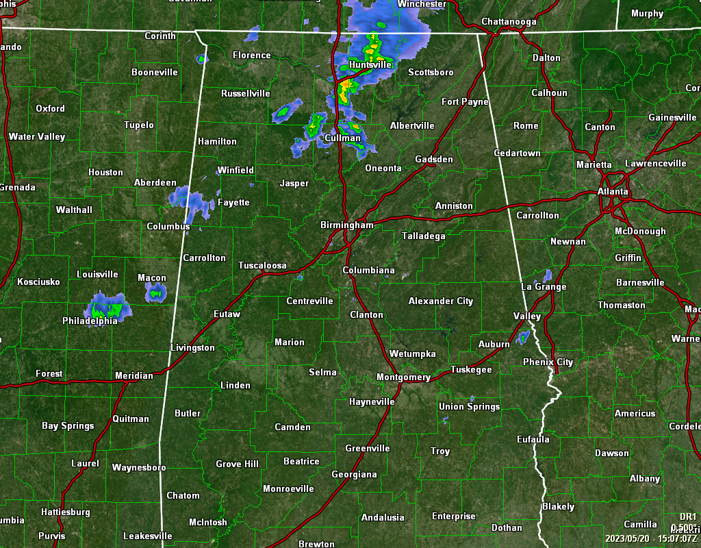
As of 10:10 am, we have some shower activity moving across the central portions of the Tennessee Valley and down into the extreme northern parts of Central Alabama, along with some light rain moving across portions of Lamar County. At this point, everything is staying well-behaved, but a few storms might get a little active this afternoon.
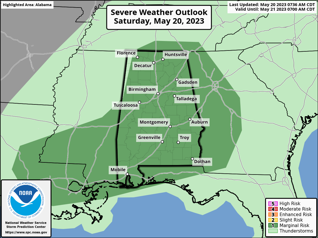
A Marginal Risk for severe storms continues for much of the state, except for a small sliver of the extreme western parts of North/Central Alabama. Isolated damaging wind gusts up to 60 mph and isolated quarter size hail will be the main threats today; however, the brief tornado threat is non-zero. The window for stronger to severe storms will be from 12 pm to 10 pm from northwest to southeast.
The 10 am roundup shows that temperatures were in the mid 60s to the upper 70s across the area. Haleyville was the cool spot at 66º. Troy was the warm spot at 78º. Birmingham was at 72º. Highs will get up into the mid 70s to the mid 80s.
Category: Alabama's Weather, ALL POSTS, Severe Weather
About the Author (Author Profile)
Scott Martin is an operational meteorologist, professional graphic artist, musician, husband, and father. Not only is Scott a member of the National Weather Association, but he is also the Central Alabama Chapter of the NWA president. Scott is also the co-founder of Racecast Weather, which provides forecasts for many racing series across the USA. He also supplies forecasts for the BassMaster Elite Series events including the BassMaster Classic.Subscribe
If you enjoyed this article, subscribe to receive more just like it.


