Radar Update 3:35 p.m.: Storms Pushing Southeastward
Partly cloudy skies across much of the area have allowed temperatures to warm into the 70s and 80s across the area.
With dewpoints in the lower 70s ahead of the cold front, instabilities have gotten fairly high across Alabama, and this is powering storms.
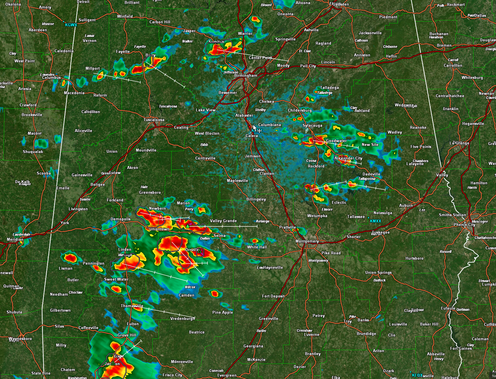
A line of broken thunderstorms is just northwest of I-59 from Fort Payne to Albertville to Sumiton to Berry. This line is pushing southeast at 30 mph, and at this rate will affect areas from Gadsden to Birmingham over the next 90 minutes. You can expect lightning, gusty winds, and very heavy rain. There might be some small hail in the storm near Holly Pond that is tracking along US-278 and heading toward Gadsden.
It looks like one of the stronger storms is going to affect the northwestern part of Jefferson County.
Storms have also formed in the US-280 Corridor from Childersburg to Dadeville.
To the southwest, a large complex of storms has formed over Hale, Perry, Dallas, and Marengo Counties. These storms are also pushing east southeastward into Selma and toward Montgomery eventually.
We continue to monitor the storms for strengthening. A couple of them could become severe, with damaging wind gusts and hail.
Category: ALL POSTS
About the Author (Author Profile)
Bill Murray is the President of The Weather Factory. He is the site's official weather historian and a weekend forecaster. He also anchors the site's severe weather coverage. Bill Murray is the proud holder of National Weather Association Digital Seal #0001 @wxhistorianSubscribe
If you enjoyed this article, subscribe to receive more just like it.


