Midday Nowcast: A Great May Friday
It is a beautiful Friday across Alabama with ample sunshine, low humidity, and comfortable temperatures. Afternoon highs will be mostly in the low 80s to end the work week.
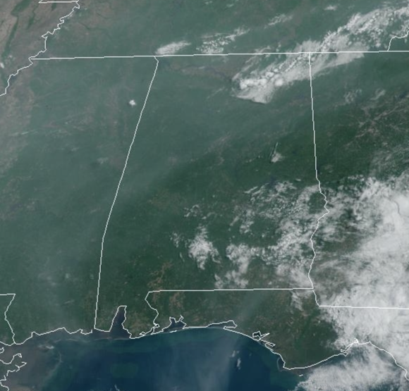
We continue to have haze in the air due to wildfires in Canada. Rain chances are near zero for most of us, but we can’t rule out an isolated shower somewhere across the northern third of Alabama later today. Tonight will be mostly clear and very nice with lows in the mid to upper 50s.
IN THE TROPICS: A broad non-tropical area of low pressure located east of the northeastern coast of Florida and an associated frontal boundary off the coast of the southeastern United States are producing a large area of disorganized showers and thunderstorms. The low is unlikely to become a subtropical or tropical cyclone since it is forecast to remain frontal while moving generally northward and inland over the Carolinas late Saturday or Sunday.
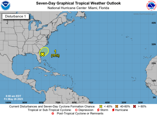
Regardless, the system is expected to produce gusty winds, and dangerous surf and rip current conditions along portions of the southeastern United States coast through Sunday. Heavy rainfall is expected in portions of the Carolinas and Virginia during the next few days. Hazardous marine conditions are also expected over the coastal and offshore waters where gale and storm warnings are in effect. Formation chance through 48 hours…low…10 percent. Formation chance through 7 days…low…10 percent.
MEMORIAL DAY WEEKEND: The low off the Southeast Coast will help our great weather continue through the long weekend; it will be mainly dry, but we will mention the chance of a few isolated showers all three days, mainly during the afternoon and evening hours. Rain chances will be in around 20% these days. Expect a mostly sunny sky with highs in the upper 70s to lower 80s for many of due to the low pressure east of us pulling down cooler air from the north.
NEXT WEEK: Much of the week looks fairly quiet with no major weather systems impacting the Deep South. There will be the usual chance of widely scattered afternoon/evening showers or storms. Heat levels begin to rise, and by the end of the week afternoon highs will be close to 90° and so will those humidity levels.
BEACH FORECAST CENTER: Get the latest weather and rip current forecasts for the beaches from Fort Morgan to Panama City on our Beach Forecast Center page. There, you can select the forecast of the region that you are interested in visiting.
WORLD TEMPERATURE EXTREMES: Over the last 24 hours, the highest observation outside the U.S. was 118.4F at Nawabshah, Pakistan. The lowest observation was -87.3F Dome A, Antarctica.
CONTIGUOUS TEMPERATURE EXTREMES: Over the last 24 hours, the highest observation was 104F at Eloy, AZ. The lowest observation was 22F at Roscommon, MI.
Category: Alabama's Weather, ALL POSTS
About the Author (Author Profile)
Macon, Georgia Television Chief Meteorologist, Birmingham native, and long time Contributor on AlabamaWX. Stormchaser. I did not choose Weather, it chose Me. College Football Fanatic. @Ryan_StinnetSubscribe
If you enjoyed this article, subscribe to receive more just like it.


