Midday Nowcast: Mainly Sunny and Hazy
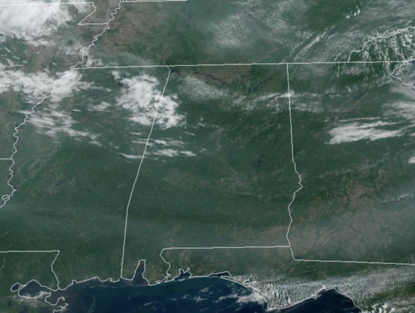
A surface front is dropping south through the state today, allowing for scattered showers and storms, mainly across Central and South Alabama, but many locations will remain dry. Rain chance today are in the 20-30% range this afternoon. Heat levels are lower today with highs in the mid to upper 80s across North/Central Alabama and the sky is mainly sunny and hazy, courtesy of the smoke from the Canadian wildfires.
ACROSS THE USA: Widespread smoke from Canadian wildfires continue to bring hazardous air quality levels across the Northeast and Mid-Atlantic, including major metro areas along the I-95 corridor. Locally heavy showers and thunderstorms, isolated severe, may develop across the northern Rockies and High Plains.
TOMORROW AND THE WEEKEND: Much drier air drops into Alabama tonight, allowing for great weather tomorrow and Saturday; on these two days we expect a mostly sunny sky and lower humidity. Rain chances will be near zero, and nights will be refreshing, with many spots reaching the 50s during the morning hours. On Sunday, moisture levels rise and we will bring back the chance of scattered, mostly afternoon and evening showers and thunderstorms with a mix of sun and clouds. Highs will remain in the upper 80s and low 90s.
NEXT WEEK: A persistence forecast is what we will go with for much of the week. Partly sunny days with the chance of a passing afternoon thunderstorm in scattered spots. By the latter half of the week, it looks like a warming trend will begin as a ridge builds in over the Deep South, meaning hotter temperatures as mid 90s are possible.
IN THE TROPICS: All is quiet in the Gulf of Mexico, Caribbean Sea, and the open waters of the Atlantic. With no development expected through the upcoming weekend.
BEACH FORECAST CENTER: Get the latest weather and rip current forecasts for the beaches from Fort Morgan to Panama City on our Beach Forecast Center page. There, you can select the forecast of the region that you are interested in visiting.
WORLD TEMPERATURE EXTREMES: Over the last 24 hours, the highest observation outside the U.S. was 118.4F at Matam, Senegal. The lowest observation was -94.4F Concordia, Antarctica.
CONTIGUOUS TEMPERATURE EXTREMES: Over the last 24 hours, the highest observation was 102F at Rio Grande Village, TX. The lowest observation was 26F at Bellemont, AZ.
Category: Alabama's Weather, ALL POSTS
About the Author (Author Profile)
Macon, Georgia Television Chief Meteorologist, Birmingham native, and long time Contributor on AlabamaWX. Stormchaser. I did not choose Weather, it chose Me. College Football Fanatic. @Ryan_StinnetSubscribe
If you enjoyed this article, subscribe to receive more just like it.


