Severe Storm Threat Continues to Slowly Push Southeastward Into Central Alabama
The severe weather threat for Severe Thunderstorm Watch 271 continues.
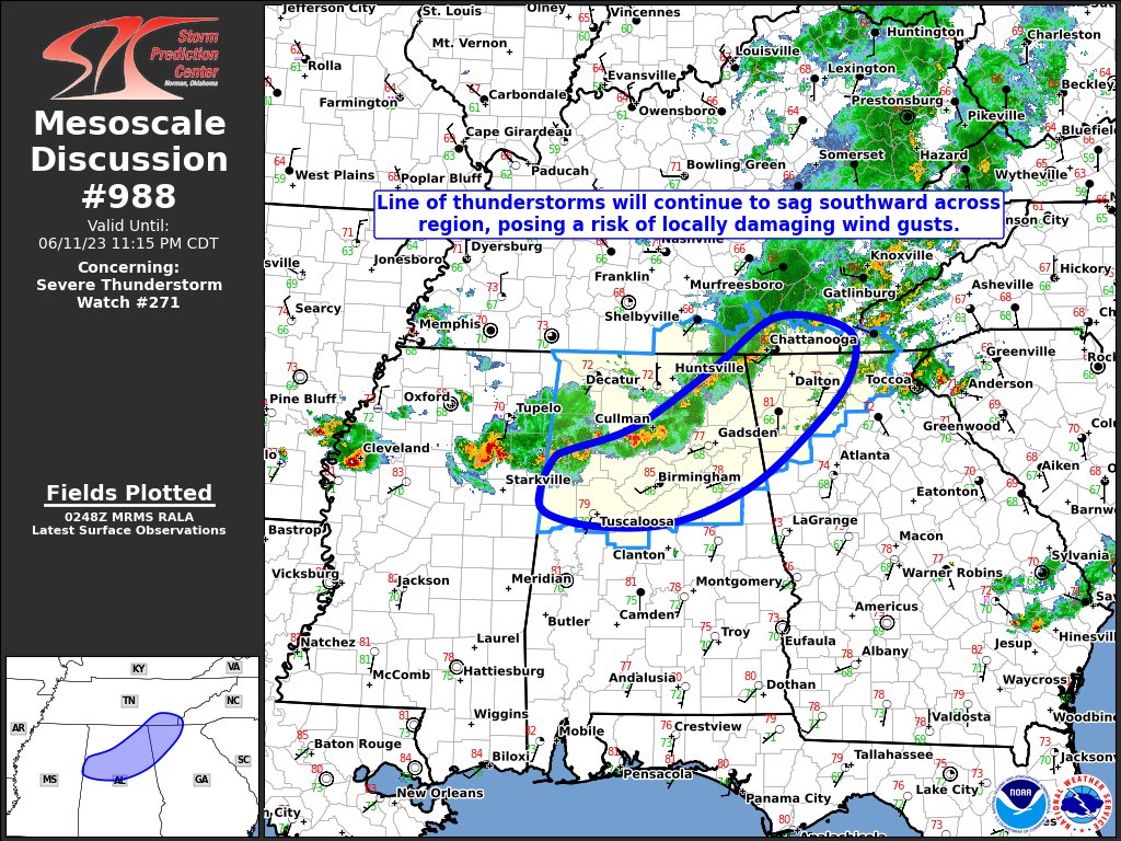
SUMMARY… A line of thunderstorms will sag southward across the region through midnight, posing a risk of locally damaging wind gusts.
DISCUSSION… Latest radar imagery shows a line of strong to severe storms extending roughly from south of Tupelo MS to south of Huntsville AL. Intensities along the line have been generally sub-severe so far. However, winds aloft are quite strong (3-5km winds of 30-40 knots on GWX and HTX VAD profiles) and several weak bowing structures continue to be observed. Given the moist and moderately unstable air mass that is present ahead of the storms, and the continued signal in evening CAM guidance for a robust squall line, the potential for locally damaging wind gusts will continue into the early morning hours.
Category: Alabama's Weather, ALL POSTS, Severe Weather
About the Author (Author Profile)
Scott Martin is an operational meteorologist, professional graphic artist, musician, husband, and father. Not only is Scott a member of the National Weather Association, but he is also the Central Alabama Chapter of the NWA president. Scott is also the co-founder of Racecast Weather, which provides forecasts for many racing series across the USA. He also supplies forecasts for the BassMaster Elite Series events including the BassMaster Classic.Subscribe
If you enjoyed this article, subscribe to receive more just like it.


