CANCELLED Severe Thunderstorm Warning for Parts of Marion, Fayette, and Lamar Counties Until 10:15 pm
Very strong winds shows from west of Guin to Beaverton to Sulligent. Will impact warning area over the next hour. Be in a center room lowest floor as the dangerous storms approach.
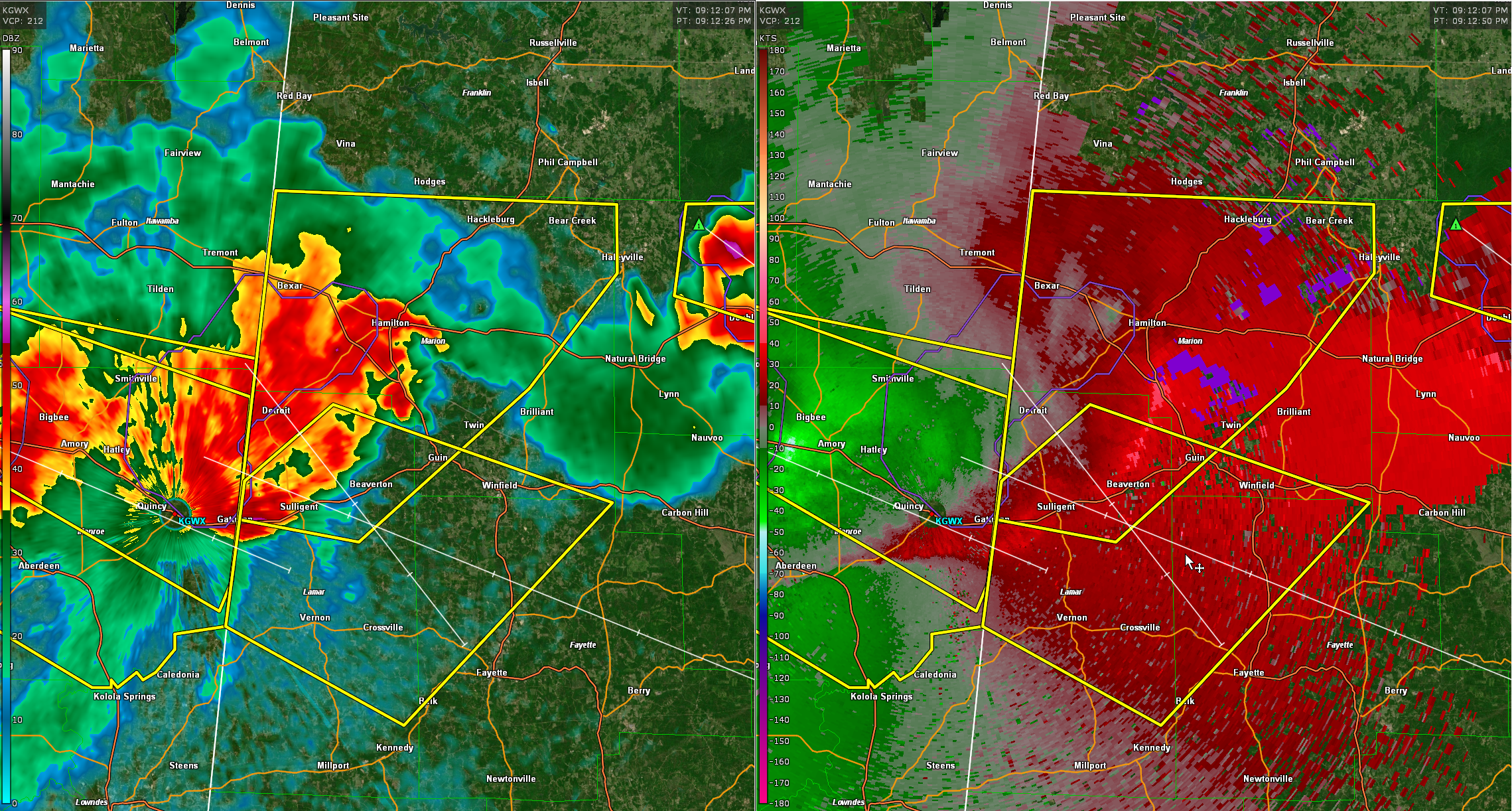
The National Weather Service in Birmingham has issued a
* Severe Thunderstorm Warning for…
South central Marion County in northwestern Alabama…
Northwestern Fayette County in west central Alabama…
Lamar County in west central Alabama…
* Until 1015 PM CDT.
* At 912 PM CDT, severe thunderstorms were located along a line
extending from 6 miles northwest of Detroit to near Smithville to
Amory, moving southeast at 50 mph.
HAZARD…60 mph wind gusts and nickel size hail.
SOURCE…Radar indicated.
IMPACT…Expect damage to roofs, siding, and trees.
* Locations impacted include…
Winfield, Vernon, Sulligent, Guin, Glen Allen, Belk, Beaverton, Gu-
Win, Blooming Grove, Lamar County Airport, Crews, Bedford, Bluff,
Crossville, Cody, Henson Springs, Bazemore, Wayside, Lamar County
Public Lake and Hubbertville.
Category: Alabama's Weather, ALL POSTS, Severe Weather
About the Author (Author Profile)
Bill Murray is the President of The Weather Factory. He is the site's official weather historian and a weekend forecaster. He also anchors the site's severe weather coverage. Bill Murray is the proud holder of National Weather Association Digital Seal #0001 @wxhistorianSubscribe
If you enjoyed this article, subscribe to receive more just like it.


