Trees Down in Tupelo…Same Storm Moving into Marion and Lamar Counties…Hytop Radar is Down
Trees were reported down around Tupelo MS at around 8:30 p.m., including one with injuries on a home. Other wind damage reports have been received as well from there.
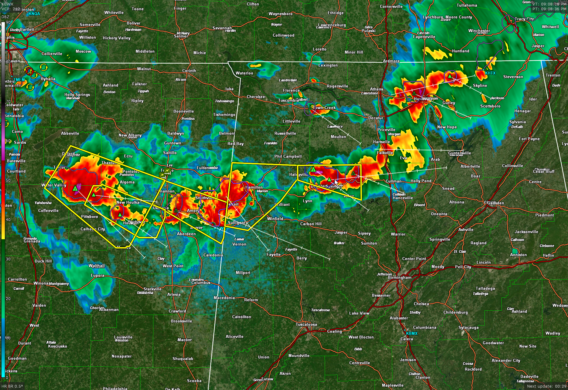
A tornado warning was issued for southern Itawamba County. The most dangerous part of that storm passed just north of Smithville MS. I am beginning to believe our friend Johnny Parker from Smithville is a tornado magnet.
This storm is now moving into Lamar and Marion Counties in Alabama, where a severe thunderstorm warning is in effect. The storm is rotating but is not considered to be a tornado threat at this time.
There is a strong storm in the Huntsville area now, but it isn’t severe.
The storms over southern Lawrence and Winston County are severe however. 1″ hail is indicated north of Double Springs. These storms will push into southern Cullman County.
Back in Mississippi, the main cluster of storms extends from south of Oxford to near Houston to North of Aberdeen to west of Hamilton in Marion County. These will be pushing into West Alabama over the next couple of hours. 60 knots winds are evident on the GWX radar west of Amory MS.
Just a note that the Hytop radar in North Alabama is down. The NWS in Huntsville is working on it.
Category: Alabama's Weather, ALL POSTS, Severe Weather
About the Author (Author Profile)
Bill Murray is the President of The Weather Factory. He is the site's official weather historian and a weekend forecaster. He also anchors the site's severe weather coverage. Bill Murray is the proud holder of National Weather Association Digital Seal #0001 @wxhistorianSubscribe
If you enjoyed this article, subscribe to receive more just like it.


