Severe Thunderstorm Warning for Tuscaloosa County – Does Not Include Cities of Tuscaloosa or Northport
This storm will move up into western parts of the Birmingham metro if it can hold together.
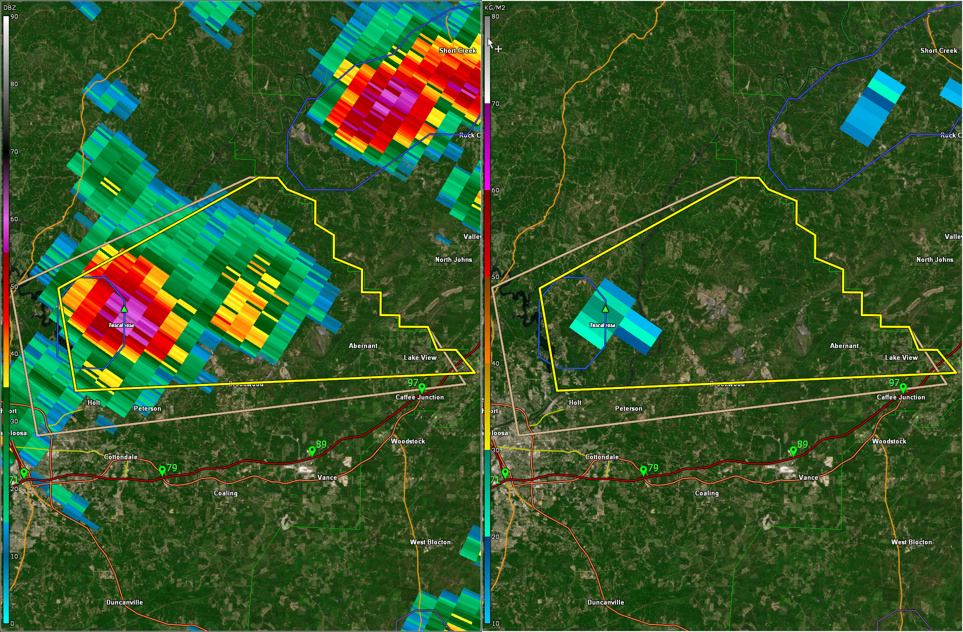
The National Weather Service in Birmingham has issued a
* Severe Thunderstorm Warning for…
East central Tuscaloosa County in west central Alabama…
* Until 215 PM CDT.
* At 133 PM CDT, a severe thunderstorm was located near Deerlick
Creek Campgrounds, or near Holt, moving east at 10 mph.
HAZARD…60 mph wind gusts and quarter size hail.
SOURCE…Radar indicated.
IMPACT…Hail damage to vehicles is expected. Expect wind damage
to roofs, siding, and trees.
* Locations impacted include…
Lake View, Brookwood, Bull City, Abernant, Deerlick Creek
Campgrounds, Lake Nicol, East Brookwood, Bucksville, Lake Nicol
Park, Holt Lock And Dam, Lake Harris and Lake Tuscaloosa.
Category: Alabama's Weather, ALL POSTS, Severe Weather
About the Author (Author Profile)
Bill Murray is the President of The Weather Factory. He is the site's official weather historian and a weekend forecaster. He also anchors the site's severe weather coverage. Bill Murray is the proud holder of National Weather Association Digital Seal #0001 @wxhistorianSubscribe
If you enjoyed this article, subscribe to receive more just like it.


