Severe Thunderstorm Warning for Marion, Winston
The core of this storm will parallel US-278 passing near or just north of Double Springs and between Double Springs and Grayson.
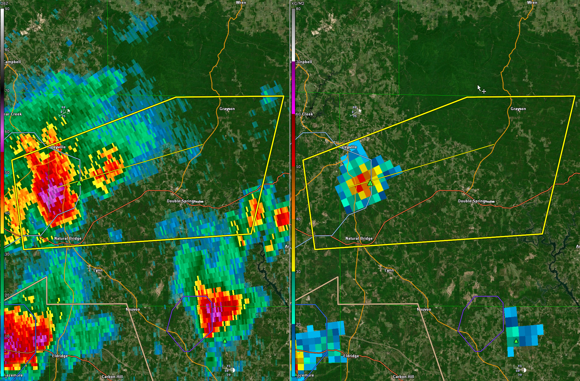
The National Weather Service in Birmingham has issued a
* Severe Thunderstorm Warning for…
East central Marion County in northwestern Alabama…
Central Winston County in northwestern Alabama…
* Until 230 PM CDT.
* At 137 PM CDT, a severe thunderstorm was located near Haleyville,
moving east at 20 mph.
HAZARD…60 mph wind gusts and quarter size hail.
SOURCE…Radar indicated.
IMPACT…Hail damage to vehicles is expected. Expect wind damage
to roofs, siding, and trees.
* Locations impacted include…
Haleyville, Double Springs, Houston Recreational Area, Corinth Rec
Area, Brushy Lake, Moreland, Winston Free State Barn, Ashridge,
Smith Lake, Natural Bridge, Weiss, Hullett Branch, Winston County
Airport, Cane Creek, Bull Branch, Mill Creek, Delmar, Sipsey River
Rec Area and Grayson.
Category: Alabama's Weather, ALL POSTS, Severe Weather
About the Author (Author Profile)
Bill Murray is the President of The Weather Factory. He is the site's official weather historian and a weekend forecaster. He also anchors the site's severe weather coverage. Bill Murray is the proud holder of National Weather Association Digital Seal #0001 @wxhistorianSubscribe
If you enjoyed this article, subscribe to receive more just like it.


