Midday Nowcast: Storm Coverage Increases this Weekend
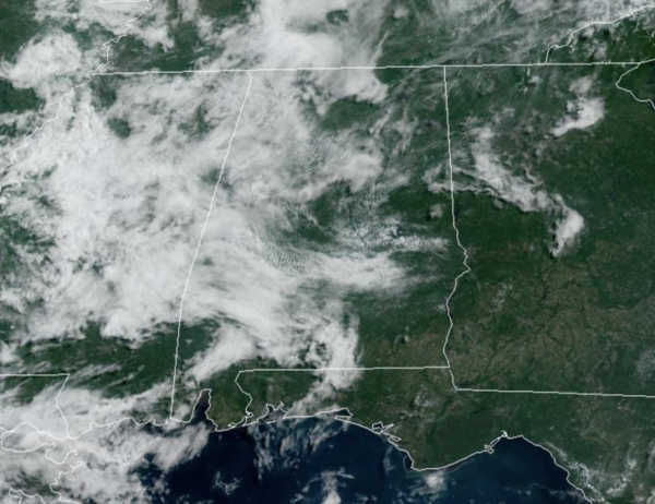
NEW DAY, SAME FORECAST: We are seeing a mix of sun and clouds with highs in the upper 80s and low 90s. The radar will again be active during the afternoon and evening hours, with some strong storms possible and a few of them could become locally severe with strong, gusty winds and hail. The storms will be random and scattered, so it won’t rain everywhere…where the storms form they will produce tremendous amounts of lightning and heavy rainfall. Again, storm placement is random, there is no way of knowing where the storms will develop, you just have to watch radar trends each day.
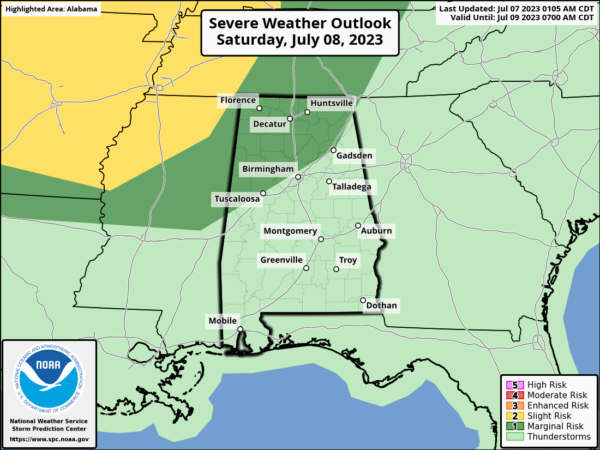
WEEKEND WEATHER: Showers and thunderstorms will increase in coverage the next two days as some upper-level energy passes through providing better dynamic support across the region. The SPC has the northwestern portions of Alabama in level 1 risk of severe storms tomorrow and tomorrow night.
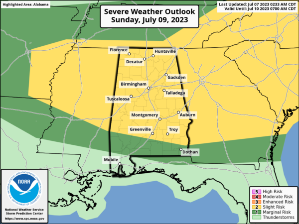
On Sunday, most of the state is in a “slight risk” (level 2/5) of severe thunderstorms for the potential for hail and strong straight line winds. Watch radar trends both days if you have any outdoor events planned. Highs both days will be in the upper 80s to lower 90s.
NEXT WEEK: Monday will feature continued higher rain chances. For the rest of the week, routine July weather is the story for now. Highs in the low 90s, with scattered, mainly afternoon and evening showers and storms.
IN THE TROPICS: All is quiet with no development expected the next seven days in the Gulf of Mexico, the Caribbean Sea, and across the Atlantic.
BEACH FORECAST CENTER: Get the latest weather and rip current forecasts for the beaches from Fort Morgan to Panama City on our Beach Forecast Center page. There, you can select the forecast of the region that you are interested in visiting.
WORLD TEMPERATURE EXTREMES: Over the last 24 hours, the highest observation outside the U.S. was 122.4F at Omidieh, Iran. The lowest observation was -92.2F Amundsen-Scott South Pole Station, Antarctica.
CONTIGUOUS TEMPERATURE EXTREMES: Over the last 24 hours, the highest observation was 118F at Eloy, AZ. The lowest observation was 32F at Big Piney, WY.
Category: Alabama's Weather, ALL POSTS
About the Author (Author Profile)
Macon, Georgia Television Chief Meteorologist, Birmingham native, and long time Contributor on AlabamaWX. Stormchaser. I did not choose Weather, it chose Me. College Football Fanatic. @Ryan_StinnetSubscribe
If you enjoyed this article, subscribe to receive more just like it.


