Severe Thunderstorm Warning for Parts of Tuscaloosa, Pickens, Greene, Bibb, and Jefferson
Our storms have ramped up a bit again…radar indicates very strong winds with the storms…please be in a safe spot as they approach…
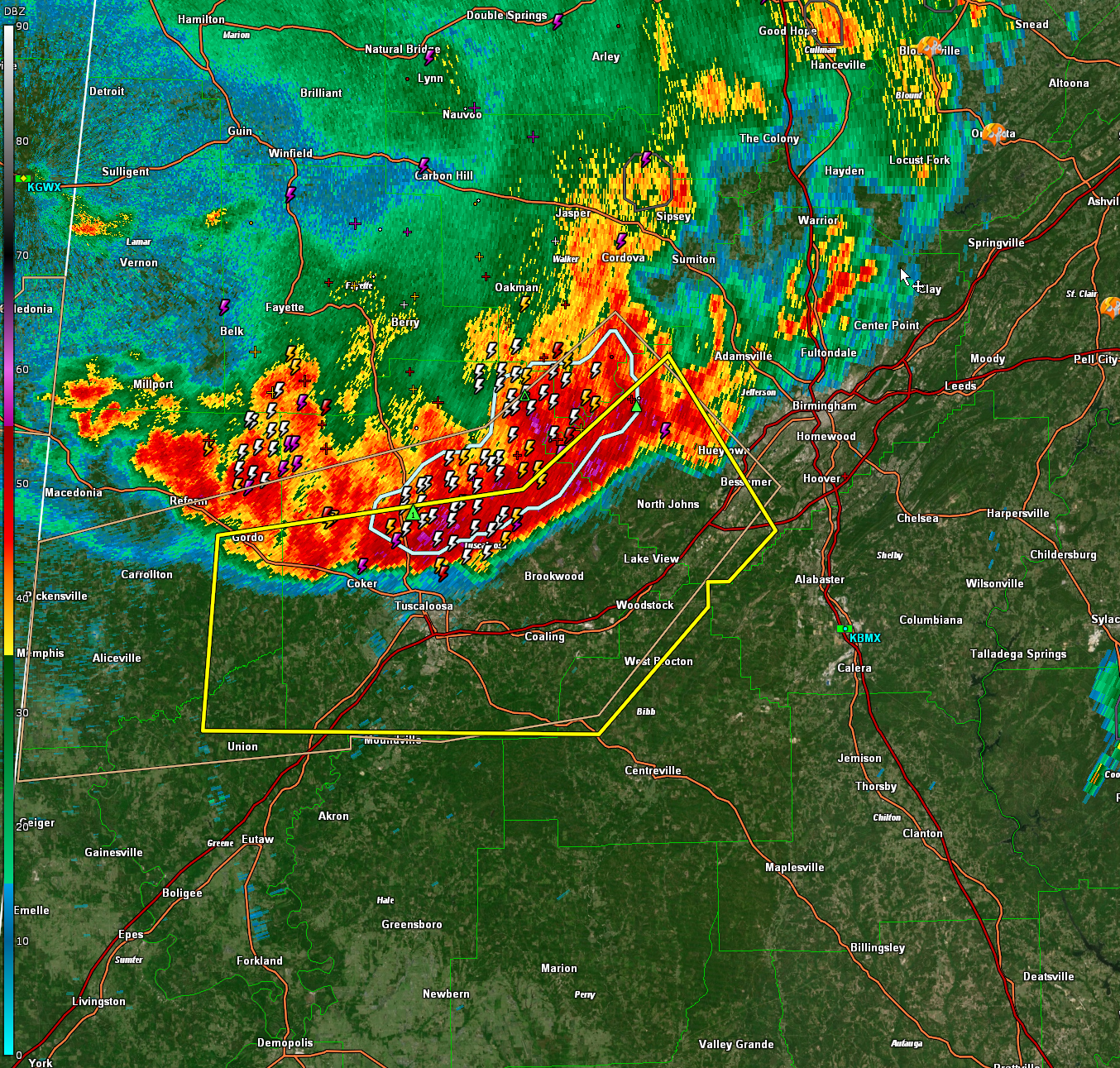
The National Weather Service in Birmingham has issued a
* Severe Thunderstorm Warning for…
Tuscaloosa County in west central Alabama…
Southeastern Pickens County in west central Alabama…
Northeastern Greene County in west central Alabama…
Northwestern Bibb County in central Alabama…
Southwestern Jefferson County in central Alabama…
* Until 1015 PM CDT.
* At 933 PM CDT, severe thunderstorms were located along a line
extending from 6 miles northwest of Concord to near Deerlick Creek
Campgrounds to Northport, moving southeast at 30 mph.
HAZARD…60 mph wind gusts and nickel size hail.
SOURCE…Radar indicated.
IMPACT…Expect damage to roofs, siding, and trees.
* Locations impacted include…
Tuscaloosa, Bessemer, Northport, Hueytown, Gordo, Holt, Pleasant
Grove, Lake View, Brookwood, Coaling, Sylvan Springs, Vance,
Woodstock, West Blocton, Coker, North Johns, Bull City, McFarland
Mall, Benevola and Lake Lurleen State Park.
PRECAUTIONARY/PREPAREDNESS ACTIONS…
For your protection move to an interior room on the lowest floor of a
building.
Category: Alabama's Weather, ALL POSTS, Severe Weather
About the Author (Author Profile)
Bill Murray is the President of The Weather Factory. He is the site's official weather historian and a weekend forecaster. He also anchors the site's severe weather coverage. Bill Murray is the proud holder of National Weather Association Digital Seal #0001 @wxhistorianSubscribe
If you enjoyed this article, subscribe to receive more just like it.


