New Severe Thunderstorm Warning
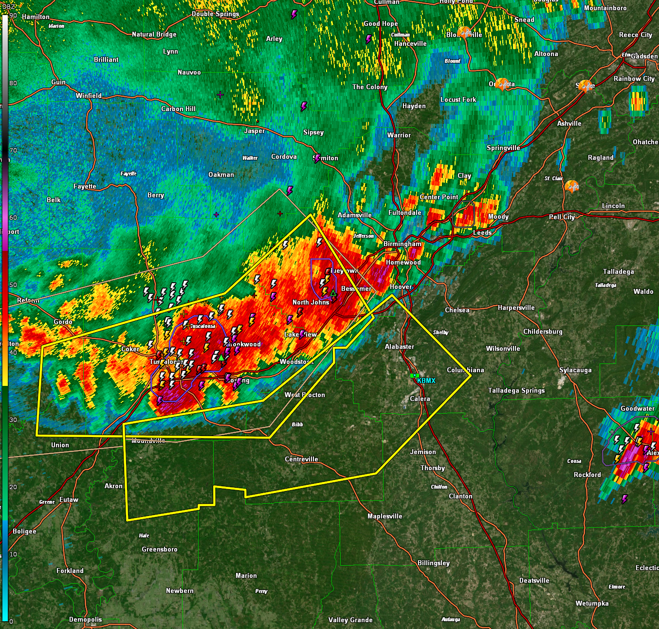
The National Weather Service in Birmingham has issued a
* Severe Thunderstorm Warning for…
North central Chilton County in central Alabama…
Southeastern Tuscaloosa County in west central Alabama…
Southwestern Shelby County in central Alabama…
Northeastern Hale County in west central Alabama…
Bibb County in central Alabama…
South central Jefferson County in central Alabama…
* Until 1045 PM CDT.
* At 955 PM CDT, severe thunderstorms were located along a line
extending from Ross Bridge to near Woodstock to near Shelton State
Community College, moving southeast at 30 mph.
HAZARD…60 mph wind gusts.
SOURCE…Radar indicated.
IMPACT…Expect damage to roofs, siding, and trees.
* Locations impacted include…
Hoover, Alabaster, Pelham, Helena, Calera, Montevallo, Brent,
Columbiana, Centreville, Moundville, West Blocton, Wilton, American
Village, Maylene, Brierfield Ironworks Park, Low Gap, Mertz, Hoover
Metropolitan Stadium, University Of Montevallo and Eoline.
PRECAUTIONARY/PREPAREDNESS ACTIONS…
For your protection move to an interior room on the lowest floor of a
building.
Category: Alabama's Weather, ALL POSTS, Severe Weather
About the Author (Author Profile)
Bill Murray is the President of The Weather Factory. He is the site's official weather historian and a weekend forecaster. He also anchors the site's severe weather coverage. Bill Murray is the proud holder of National Weather Association Digital Seal #0001 @wxhistorianSubscribe
If you enjoyed this article, subscribe to receive more just like it.


