Midday Nowcast: More Heat, Some Storms
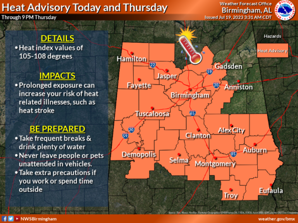
MORE HEAT, SOME STORMS: Highs in the mid to upper 90s again today with a mix of sun and clouds; heat index values across much of Alabama will exceed 105° at times today and a Heat Advisory has been issued for a large portion of Alabama.
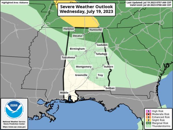
Portions of the Tennessee Valley are under a “marginal risk” (level 1/5) of severe storms again today. The main issue will come from damaging wind gusts.
REST OF THE WEEK: Hot and generally dry weather highlights the forecast for much of Alabama tomorrow and Friday. Highs will remain in the mid to upper 90s and rain chances remain low, but not zero. Again, stronger storms are likely across the Tennessee Valley of the state.
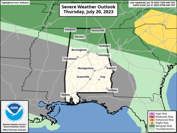
By late Friday, but an approaching surface boundary will bring showers and storms into the state late in the day and into Friday night. Some of these storms are will bring a damaging wind threat to Central Alabama as they move through, and SPC has defined a “marginal risk” (level 1/5) for much of Alabama for this threat Friday night.
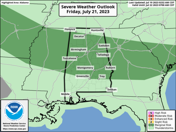
THE ALABAMA WEEKEND: Showers and storms will remain possible Saturday as the front sags southward…they will be most numerous over the southern 2/3 of the state. This won’t be an “all day” rain, and the sun will be out at times. Heat levels come way down as most places will see highs in the mid to upper 80s. On Sunday, the northern half of the state will be in a drier airmass. The sky will be mostly sunny with lower humidity levels, but it will be rather comfortable for a late July Day, the high will be near 90°. Scattered storms will remain possible Sunday across the southern counties.
NEXT WEEK: For now the week looks fairly quiet with mostly sunny days with isolated to widely scattered afternoon showers or storms…highs will be in the low to mid 90s, which is pretty much what we expect in late July in Alabama.
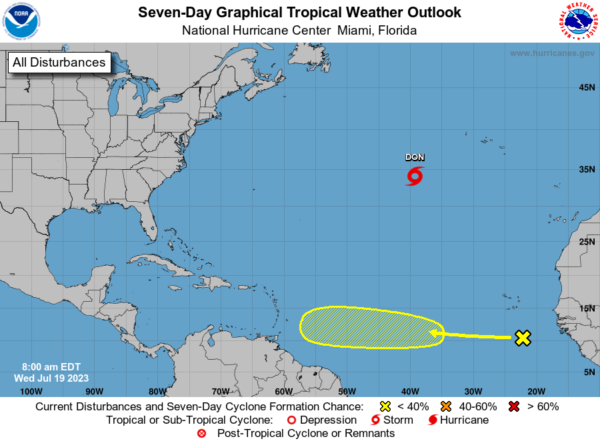
IN THE TROPICS: We still have Don in the Open Atlantic, with winds of 40 mph, it is no threat to the U.S. The rest of the basin is quiet, but we note, cloudiness and showers over the eastern tropical Atlantic centered a few hundred miles south of the Cabo Verde Islands are associated with a tropical wave. While dry air should prevent significant organization during the next few days, environmental conditions could become more conducive for some development by this weekend while the wave moves westward across the central tropical Atlantic at 15 to 20 mph. Formation chance through 7 days…low…20 percent.
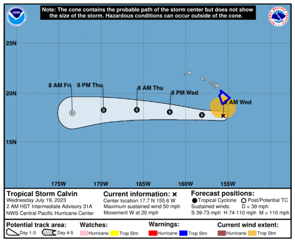
In the Central Pacific, Calvin, with winds of 50 mph is passing just south of Hawaii with tropical storms conditions for the Big Island. It will dissipate by the weekend.
BEACH FORECAST CENTER: Get the latest weather and rip current forecasts for the beaches from Fort Morgan to Panama City on our Beach Forecast Center page. There, you can select the forecast of the region that you are interested in visiting.
WORLD TEMPERATURE EXTREMES: Over the last 24 hours, the highest observation outside the U.S. was 122.9F at Al Ahsa, Saudi Arabia. The lowest observation was -92.0F Concordia, Antarctica.
CONTIGUOUS TEMPERATURE EXTREMES: Over the last 24 hours, the highest observation was 122F at Stovepipe Wells, CA. The lowest observation was 26F at Mackay, ID.
Category: Alabama's Weather, ALL POSTS
About the Author (Author Profile)
Macon, Georgia Television Chief Meteorologist, Birmingham native, and long time Contributor on AlabamaWX. Stormchaser. I did not choose Weather, it chose Me. College Football Fanatic. @Ryan_StinnetSubscribe
If you enjoyed this article, subscribe to receive more just like it.


