Alabama Weather Update at 5:30 p.m.
There are strong storms over North and Northeast Alabama at this hour.
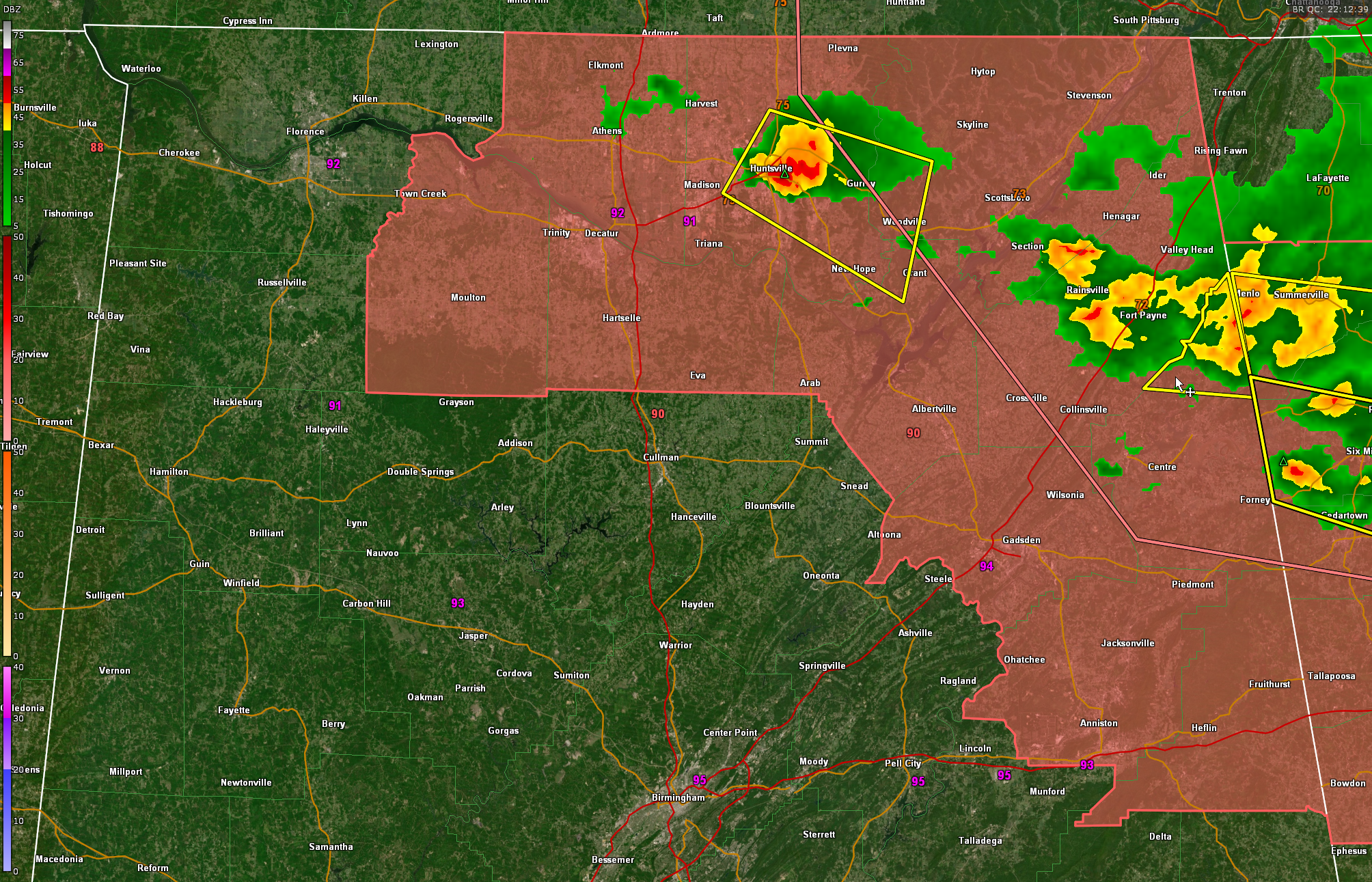
The strongest storm is in the Huntsville vicinity. Lots of lightning, torrential rains, small hail perhaps to the size of nickels and the potential for 60 mph wind gusts. This storm is moving southeast at 25 mph generally along US-72 toward Gurley and Paint Rock.
Storms over southern Jackson and DeKalb counties will be moving into Cherokee County. Places affected right now are Sylvania and Rainsville…the storms will affect areas north of Cedar Bluff in Cherokee County. Again, heavy rain, strong winds, some small hail and dangerous lightning will be the impact. A severe thunderstorm warning is in effect for Cherokee County but the Weather Service says they are not seeing the same intensity, which is great news.
Can’t rule out a tornado this afternoon and early evening, but no indications of anything with the current storms.
The NWS in Birmingham did extend the severe thunderstorm watch to include Calhoun, Cleburne, and Etowah Counties. The pink shaded counties are still in the watch.
There are indications that more storms will form after 11 pm moving into North Alabama. These storms could be strong to marginally severe with damaging winds the main threat. Not enough shear for tornadoes later tonight. These rather isolated thunderstorms will potentially hang on into the morning hours tomorrow.
But the main action tomorrow will come by mid to late afternoon when storms fire ahead of a front across North and Central Alabama. Indications are thet the storms will be more widespread and potentially stronger. They will have decent instability, just enough speed shear to keep em organized a little, but no helicity for tornadoes. They will start in Northwest Alabama just afternoon noon and probably affect I-20 starting around 2:30-3 p.m.
So be ready to monitor the weather late tonight and especially tomorrow.
Category: Alabama's Weather, ALL POSTS, Severe Weather
About the Author (Author Profile)
Bill Murray is the President of The Weather Factory. He is the site's official weather historian and a weekend forecaster. He also anchors the site's severe weather coverage. Bill Murray is the proud holder of National Weather Association Digital Seal #0001 @wxhistorianSubscribe
If you enjoyed this article, subscribe to receive more just like it.


