Severe Thunderstorm Watch Likely Soon for North Alabama
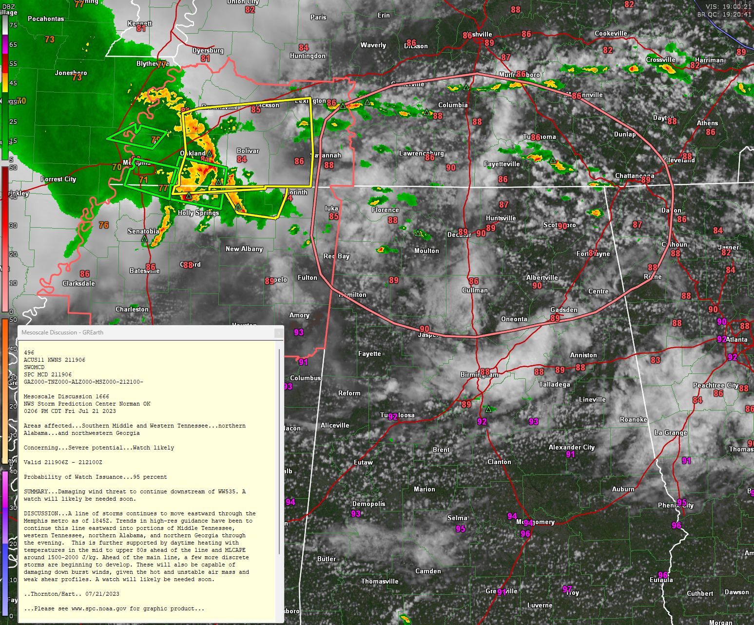
Severe thunderstorms are moving through western Tennessee and extreme northern Mississippi at this hour, heading east towards North Alabama.
Several severe thunderstorm and flash flood warnings are in effect ahead and in the wake of the storms.
Instability levels are high and there is just a smidge of bulk shear, so the storms should continue to cause problems all the way into northern Georgia. The boggest threat is damaging winds. The NWS Memphis has had destructive tags for 80 mph winds on the storms in their area.
Heavy rain will also be a big problem, especially in the areas that got heavy rain overnight and yesterday. Harvest in Madison County picked up 7.75 inches of rain in the past 24 hours. There were widespread 4-6 inch amounts across the Huntsville area.
Lightning will be a problem as well. 0 deg C are pretty high so hail should not be a problem. And tornadoes look out of the question.
Category: Alabama's Weather, ALL POSTS, Severe Weather
About the Author (Author Profile)
Bill Murray is the President of The Weather Factory. He is the site's official weather historian and a weekend forecaster. He also anchors the site's severe weather coverage. Bill Murray is the proud holder of National Weather Association Digital Seal #0001 @wxhistorianSubscribe
If you enjoyed this article, subscribe to receive more just like it.


