Severe Thunderstorm Warning for Parts of Blount, NE Jefferson, Etowah, and St. Clair Counties
Getting several reports of trees down in the Blountsville area.
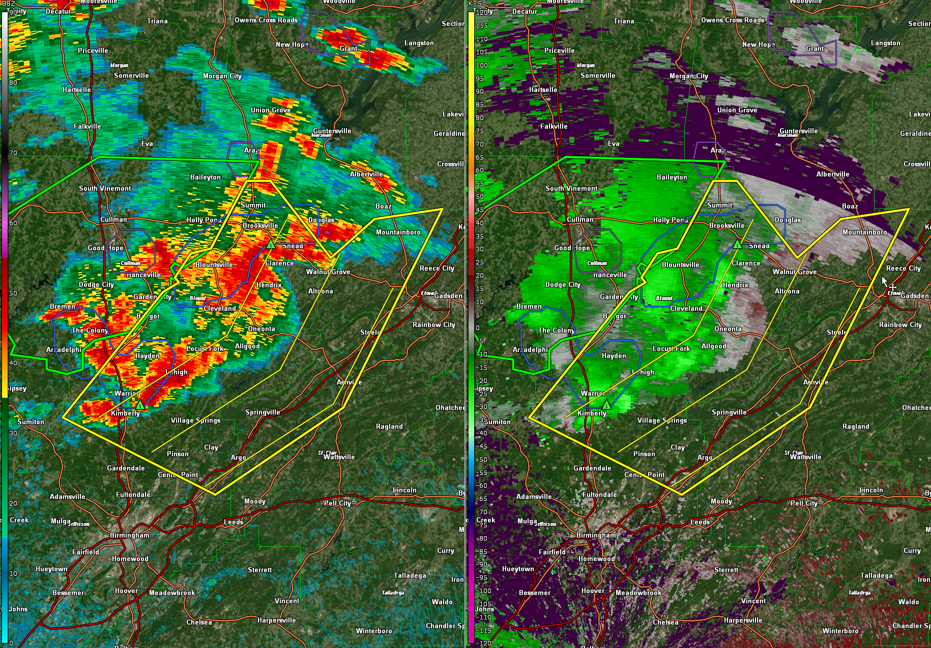
The National Weather Service in Birmingham has issued a
* Severe Thunderstorm Warning for…
Blount County in central Alabama…
Northwestern Etowah County in northeastern Alabama…
Northeastern Jefferson County in central Alabama…
Northwestern St. Clair County in central Alabama…
* Until 515 PM CDT.
* At 430 PM CDT, severe thunderstorms were located along a line
extending from McLarty to Fairview to near Kimberly, moving
southeast at 25 mph.
HAZARD…60 mph wind gusts and quarter size hail.
SOURCE…Radar indicated.
IMPACT…Hail damage to vehicles is expected. Expect wind damage
to roofs, siding, and trees.
* Locations impacted include…
Trussville, Gardendale, Oneonta, Springville, Blountsville,
Cleveland, Dallas, Center Point, Clay, Pinson, Margaret, Argo,
Warrior, Kimberly, Ashville, Morris, Sardis City, Locust Fork,
Steele and Altoona.
Category: Alabama's Weather, ALL POSTS, Severe Weather
About the Author (Author Profile)
Bill Murray is the President of The Weather Factory. He is the site's official weather historian and a weekend forecaster. He also anchors the site's severe weather coverage. Bill Murray is the proud holder of National Weather Association Digital Seal #0001 @wxhistorianSubscribe
If you enjoyed this article, subscribe to receive more just like it.


