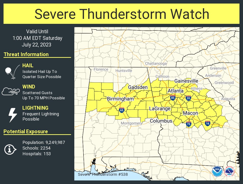
Severe Thunderstorm Watch for North Central Alabama Til Midnight
Watch includes:
Bibb, Blount, Calhoun, Chambers, Cherokee, Chilton, Clay, Cleburne, Coosa, Etowah, Fayette, Jefferson, Lamar, Marion, Pickens, Randolph, Shelby, St. Clair, Talladega, Tallapoosa, Tuscaloosa, Walker, and Winston Counties
Preliminary watch info…
SPC AWW 212151
WW 538 SEVERE TSTM AL GA 212155Z – 220500Z
AXIS..130 STATUTE MILES EAST AND WEST OF LINE..
25NNW GAD/GADSDEN AL/ – 35E CSG/COLUMBUS GA/
..AVIATION COORDS.. 115NM E/W /50NE VUZ – 36WSW MCN/
HAIL SURFACE AND ALOFT..1 INCH. WIND GUSTS..60 KNOTS.
MAX TOPS TO 500. MEAN STORM MOTION VECTOR 29030.
LAT…LON 34288397 32508210 32508656 34288852
THIS IS AN APPROXIMATION TO THE WATCH AREA. FOR A
COMPLETE DEPICTION OF THE WATCH SEE WOUS64 KWNS
FOR WOU8.
Category: Alabama's Weather, ALL POSTS, Severe Weather
About the Author (Author Profile)
Bill Murray is the President of The Weather Factory. He is the site's official weather historian and a weekend forecaster. He also anchors the site's severe weather coverage. Bill Murray is the proud holder of National Weather Association Digital Seal #0001 @wxhistorianSubscribe
If you enjoyed this article, subscribe to receive more just like it.


