Midday Nowcast: Sunny, Hot Late July Weather
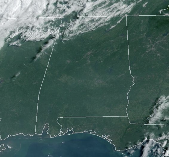
DOG DAYS OF SUMMER: The weather the rest of this week, through the weekend, and into next week just will not change much. An upper-ridge will be intensifying across the Deep South this week, meaning hotter temperatures and lower rain chances.
The days will feature more sun than clouds with highs in the mid to upper 90s right on into next week. Average high this time of year for Birmingham is 91°, which means temperatures will be above average. Rain chances are very low, but not zero, and for now, at no time the next 7-10 days are rain chances higher than 20% on any given day.
Humidity levels will begin to inch upward by the weekend, and that will cause our heat index values to be in the 100°-105° range by this weekend. We could see some heat advisories issued across portions of Alabama this weekend and into next week. Stay cool, and in case you were wondering, fall officially begins in the 59 days, on September 23.
AIR QUALITY ALERT: The smoke from the Canadian Wildfires remains in the Alabama air this week and the Alabama Department of Environmental Management continues an Air Quality Alert for Jefferson and Shelby Counties for today. Under Code Orange conditions, ground level ozone concentrations are expected to reach levels that are unhealthy for sensitive groups. Children and people with asthma are individuals most at risk under these expected conditions. This will likely get extended for several more days this week.
ACROSS THE USA: Summer heat wave builds across the central and eastern U.S. and excessive heat continues in the Southwest. An upper level system may produce storms capable of damaging winds, tornadoes, large hail, and heavy rain in the Great Lakes. The tail end of this system may also spark severe storms in the Plains. Critical fire weather in place for parts of the Northwestern U.S. and interior Alaska.
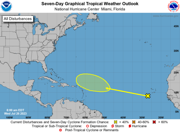
IN THE TROPICS: A tropical wave is located just to the southwest of the Cabo Verde Islands. Some development of this system is possible later this week and into the weekend while it moves westward to west-northwestward over the tropical Atlantic. Formation chance through 7 days…low…30 percent.
BEACH FORECAST CENTER: Get the latest weather and rip current forecasts for the beaches from Fort Morgan to Panama City on our Beach Forecast Center page. There, you can select the forecast of the region that you are interested in visiting.
WORLD TEMPERATURE EXTREMES: Over the last 24 hours, the highest observation outside the U.S. was 122.0F at Basrah-Hussen, Iraq. The lowest observation was -109.1F Concordia, Antarctica.
CONTIGUOUS TEMPERATURE EXTREMES: Over the last 24 hours, the highest observation was 123F at Death Valley and Stovepipe Wells, CA. The lowest observation was 33F at Old Station, CA.
Category: Alabama's Weather, ALL POSTS
About the Author (Author Profile)
Macon, Georgia Television Chief Meteorologist, Birmingham native, and long time Contributor on AlabamaWX. Stormchaser. I did not choose Weather, it chose Me. College Football Fanatic. @Ryan_StinnetSubscribe
If you enjoyed this article, subscribe to receive more just like it.


