

Midday Nowcast: Hot, Hot, Hot
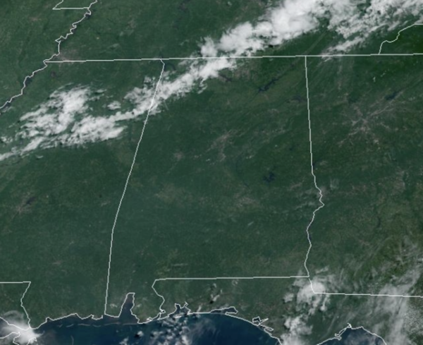
New day, same forecast across Alabama today and through the weekend. The upper-ridge continues to expand across much of the U.S., including the Deep South, keeping our temperatures above average and rain chances rather low.
The days continue to feature more sun than clouds with highs in the mid to upper 90s; the average high this time of year for Birmingham is 91°. Rain chances are low, but not zero, and for now rain chances are in the 10-20% range. Most locations will remain dry, but if you find yourself under one of those random, afternoon and evening showers and storms, you can expect gusty winds, torrential rainfall, and tremendous amounts of lightning.
Humidity levels are inching upward as well, and that will cause our heat index values to climb into the 100°-105° range in the coming days. We could see some heat advisories issued across portions of Alabama this weekend and into next week. We note, much of the Midwest, Plains, Ohio Valley, Mid-Atlantic, and Northeast have heat alerts in place already.
ACROSS THE USA: The long-duration heatwave will continue in the Southwest U.S. through Saturday while hot temperatures are forecast to spread from the Central to the Eastern U.S. Dangerously hot conditions with heat index values up to 115 degrees Fahrenheit are possible. Widespread Heat Advisories and Excessive Heat Warnings have been issued. Heat is the leading cause of weather-related deaths most years.
NEXT WEEK: The ridge will remain in place and August will start the way July ends…very hot with isolated afternoon storms. Highs will continue to be in the mid to upper 90s much of the week. Towards the and of the week, the ridge could weaken a bit, and that would allow heat levels to decrease some, and rain chances to increase.
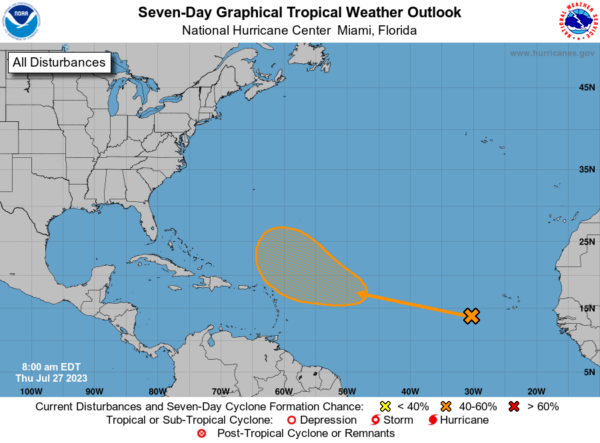
IN THE TROPICS: A tropical wave is located several hundred miles to the southwest of the Cabo Verde Islands. Conditions are expected to be favorable for gradual development of this system later this week, and a tropical depression could form over the weekend or early next week while it moves westward to west-northwestward over the tropical Atlantic. Formation chance through 7 days…medium…40 percent.
BEACH FORECAST CENTER: Get the latest weather and rip current forecasts for the beaches from Fort Morgan to Panama City on our Beach Forecast Center page. There, you can select the forecast of the region that you are interested in visiting.
WORLD TEMPERATURE EXTREMES: Over the last 24 hours, the highest observation outside the U.S. was 122.0F at Basrah-Hussen, Iraq. The lowest observation was -98.1F Concordia, Antarctica.
CONTIGUOUS TEMPERATURE EXTREMES: Over the last 24 hours, the highest observation was 122F at Stovepipe Wells, CA. The lowest observation was 27F at Bynum, MT.
Category: Alabama's Weather, ALL POSTS
About the Author (Author Profile)
Macon, Georgia Television Chief Meteorologist, Birmingham native, and long time Contributor on AlabamaWX. Stormchaser. I did not choose Weather, it chose Me. College Football Fanatic. @Ryan_StinnetSubscribe
If you enjoyed this article, subscribe to receive more just like it.


