Early Sunday Evening Weather Update
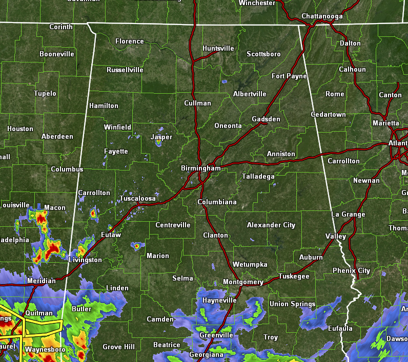
We have made it through the entire afternoon, and we only had the one severe thunderstorm warning issued for Hale County back around 2pm. The latest look at radar shows us that much of the activity has pushed south of the area, but showers and storms do remain along and south of I-85 and the US-80 corridors in the southeast. We also have some scattered showers and storms over portions of Greene, Hale, Pickens, Sumter, and Marengo counties, and one storm over Jasper.
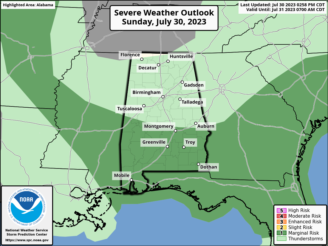
None of this activity is severe; however, the SPC continues a Marginal Risk for severe storms for locations along and south of a line from Geiger to Autaugaville to Smiths Station for the threat of damaging winds and quarter-size hail. The next update should clear those locations in Central Alabama of the Marginal Risk, as NWS Birmingham has now changed the messaging of the Hazardous Weather Outlook to “No hazardous weather is expected through tonight.”
A small update to Monday’s weather has a very small chance of a few isolated storms for locations south of a line from Tuscaloosa to Montgomery to Eufaula during the afternoon, where humidity levels will remain elevated for a little while. The rest of Central Alabama will be less humid and a little more bearable as skies will be mostly sunny with highs in the lower to mid 90s for most. Montgomery and some closely-surrounding locations may briefly hit the upper 90s.
Category: Alabama's Weather, ALL POSTS, Severe Weather
About the Author (Author Profile)
Scott Martin is an operational meteorologist, professional graphic artist, musician, husband, and father. Not only is Scott a member of the National Weather Association, but he is also the Central Alabama Chapter of the NWA president. Scott is also the co-founder of Racecast Weather, which provides forecasts for many racing series across the USA. He also supplies forecasts for the BassMaster Elite Series events including the BassMaster Classic.Subscribe
If you enjoyed this article, subscribe to receive more just like it.


