Alabama Update at 5:05 p.m.: Storms Pushing South…More Storms Possible During Early Morning Hours
The following counties have been canceled from the watch: Clay, and Shelby, and Talladega.
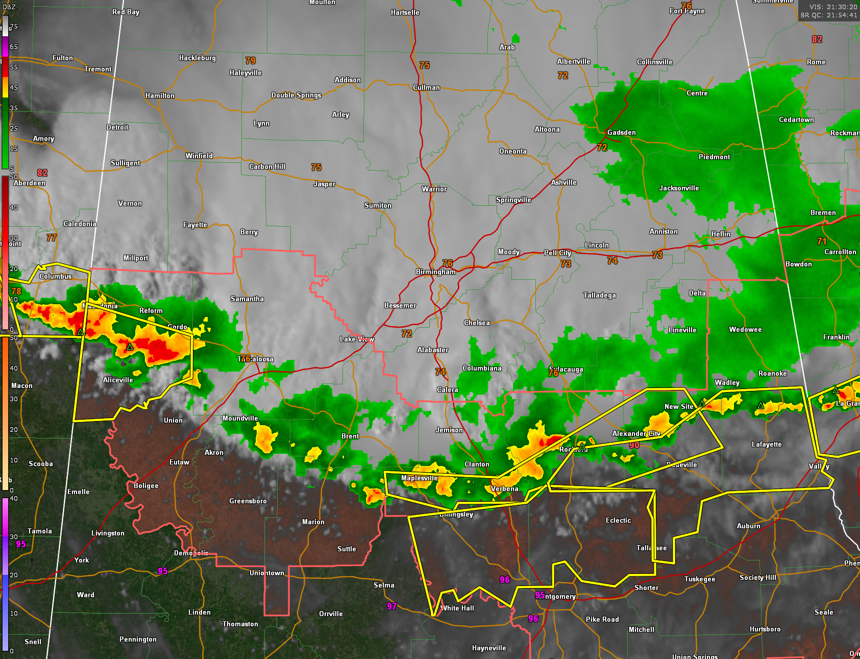
Bullock and Montgomery have been added to the watch.
The West Alabama storms have intensified and a severe thunderstorm warning is now in effect for parts of Pickens County. Powerful storms are located just south of US-82 from Ethelsville to Reform to Gordo and Elrod.
The main line now extends from Moundville in Hale County to Maplesville to Verbena to near Rockford to Jackson’s Gap in Tallapoosa COunty to Daviston in NE Tallapoosa County to Five Points in Chambers County. Warnings now blanket the path in front of these storms from northwest of Montgomery all the way to the Atlanta suburbs.
The good news is that the storms from Hale to Coosa County has laid down a strong outflow boundary that is moving out ahead of them. This means they may weaken.
Winds gusted to 43 mph at the Shelby County Airport as the storms arrived.
HEAD’S UP
More storms are forecast by the HRRR model to form overnight in the 2-3 a.m. time frame in the I-22/US-280 Corridor. They will intensify and push slowly southward through the morning hours and early afternoon. So you could be awakened by more loud storms during the pre-dawn hours. Keep your sources of warnings close while you sleep in case any warnings are issued, since the storms could be strong to severe.
Category: Alabama's Weather, ALL POSTS, Severe Weather
About the Author (Author Profile)
Bill Murray is the President of The Weather Factory. He is the site's official weather historian and a weekend forecaster. He also anchors the site's severe weather coverage. Bill Murray is the proud holder of National Weather Association Digital Seal #0001 @wxhistorianSubscribe
If you enjoyed this article, subscribe to receive more just like it.


