A Quick Bedtime Look at Central Alabama’s Weather Situation

HRRR Valid at 7am Friday morning.
While it is quiet across the state as of 9 pm tonight, the models are hinting at more storms developing during the overnight hours and moving into the northern parts of the state at some point between 12 am and 2 am. The latest run of the HRRR shows that happening with activity continuing to develop through the pre-dawn hours with much of the eastern half of the state seeing rain and storms around 7 am. By the time we get to 10 am, the HRRR is showing another MCS moving into the northern parts of the state and moving southward through the rest of the morning and into the afternoon hours.
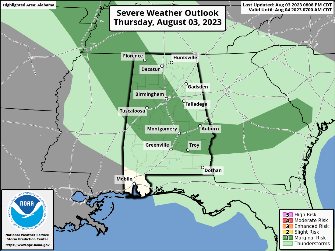
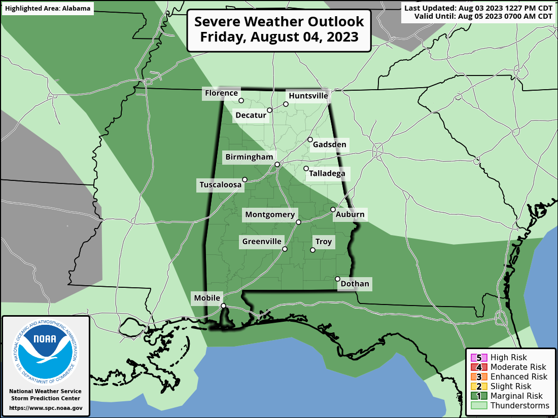
Much of the area south of a line from Rogersville to Locust Fork to Dadeville remains under a Marginal Risk for severe storms through the rest of tonight until 7 am tomorrow morning. After 7 am, a Marginal Risk is up for everyone in the state south of a line from Cherokee to Birmingham to Phenix City. Damaging winds gusts will be the main threat, as hail and tornadoes are not expected.
The best thing to do is have your NOAA WeatherRadio ready to sound off if a warning is issued for your location, so you can get to a safe place if damaging winds are approaching.
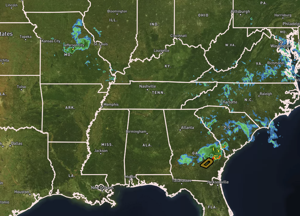
The latest look at radar shows a back of rain and storms located over east-central Missouri and that will be heading in our direction. This may be the MCS that will build through the overnight and into the early morning hours that may sweep into North Alabama by the late morning hours. We’ll keep our eyes on the radar.
Spann fans will rejoice as he will once again bring the morning weather briefing live to you (or you can watch the recorded briefing at anytime afterwords). He’ll have the latest update at some point before 6 am.
Category: Alabama's Weather, ALL POSTS, Severe Weather
About the Author (Author Profile)
Scott Martin is an operational meteorologist, professional graphic artist, musician, husband, and father. Not only is Scott a member of the National Weather Association, but he is also the Central Alabama Chapter of the NWA president. Scott is also the co-founder of Racecast Weather, which provides forecasts for many racing series across the USA. He also supplies forecasts for the BassMaster Elite Series events including the BassMaster Classic.Subscribe
If you enjoyed this article, subscribe to receive more just like it.


