Radar Check at 11:45 a.m.
It has been a wet morning across much of North and Central Alabama. Excessive rainfall amounts were reported from the Decatur area down through Blount County to Pell City. As much as 7.45-7.61 inches fell there in southern Blount and northern St. Clair County over the past 24 hours.
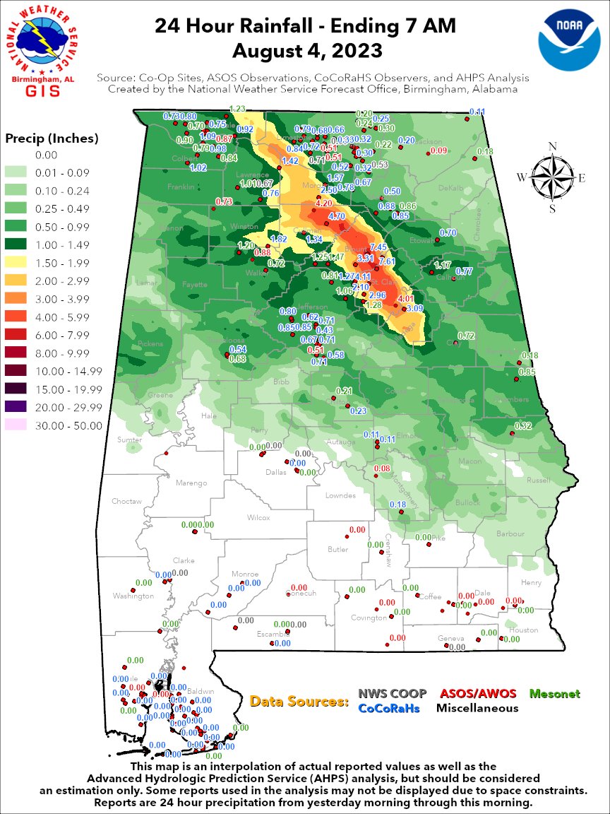
Water rescues were reported in Oneonta.
Fortunately, those areas are drying out this morning. But more heavy rain is potentially on the way this afternoon to those areas.
The early morning activity pushed a boundary to the south and west, and this is where the action will be this afternoon. The higher instabilities are to the south and west in the corridor between Pickens, Tuscaloosa, Bibb, and Chilton Counties.
A strong upper level disturbance is passing through Northwest Alabama. A trailing line of storms extends back into Northeast Mississippi. In Alabama, the line is currently moving through Marion and Winston Counties. Strong storms are moving across Lamar COunty and will be moving across parts of Fayette, Pickens, and Tuscaloosa Counties over the next 45 minutes.
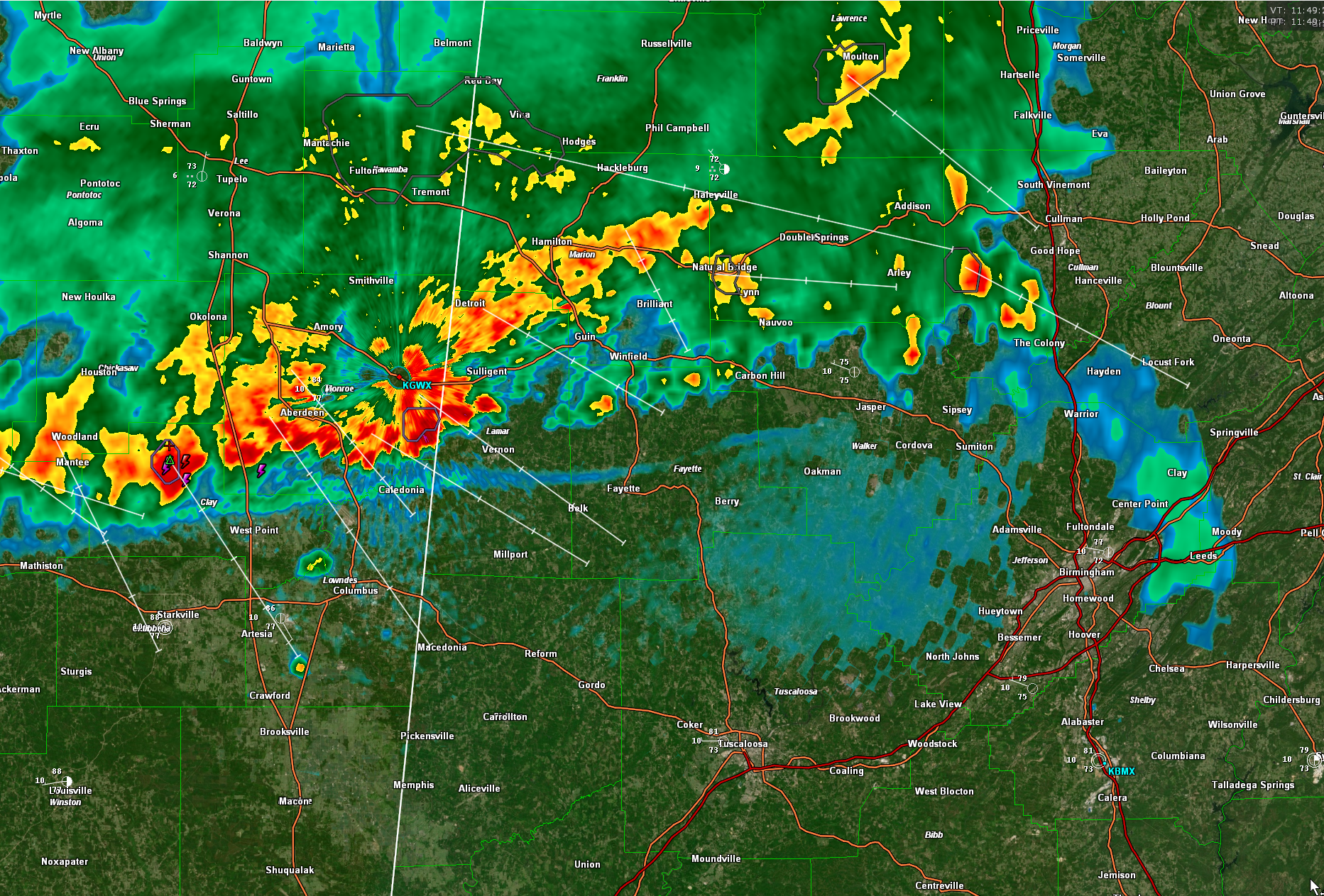
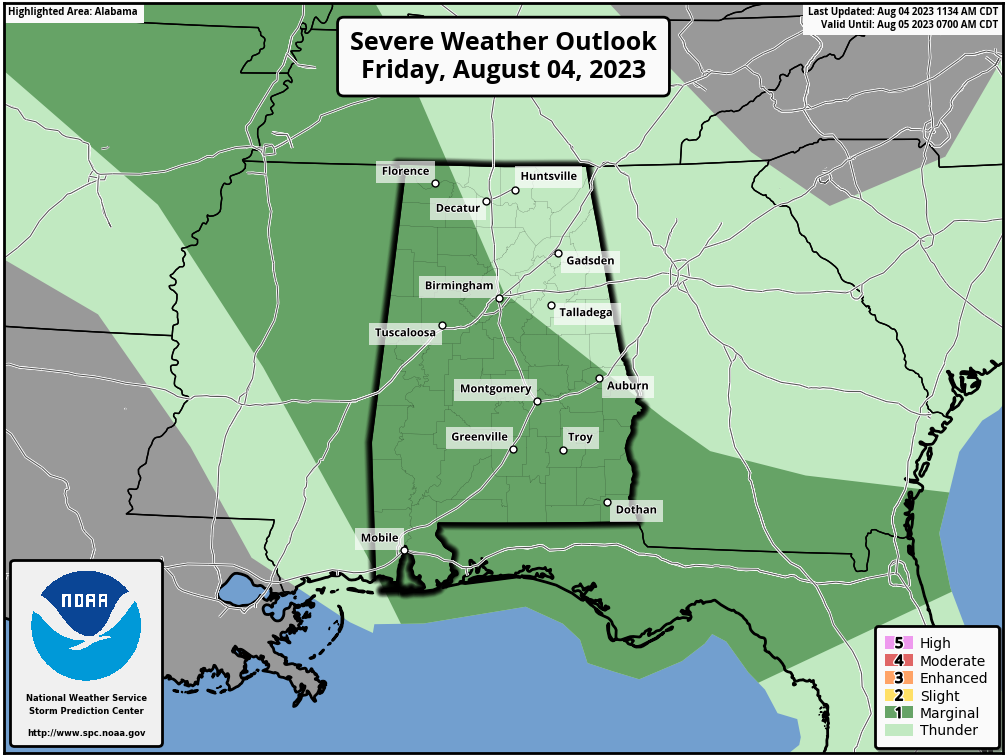
If they hold together, I think the storms will be strongest in that Pickens – Chilton County Corridor as they push southeast. There is a marginal risk of severe weather (level 1 out of 5) southwest of a line from the Shoals area down to Birmingham to near Auburn.
Flooding will be a threat as well. A flash flood watch is in effect for much of North and Central Alabama.
Rain chances will remain rather high over the next seven days as we continue in an unsettled pattern.
Category: Alabama's Weather, ALL POSTS, Severe Weather
About the Author (Author Profile)
Bill Murray is the President of The Weather Factory. He is the site's official weather historian and a weekend forecaster. He also anchors the site's severe weather coverage. Bill Murray is the proud holder of National Weather Association Digital Seal #0001 @wxhistorianSubscribe
If you enjoyed this article, subscribe to receive more just like it.


