Midday Nowcast: Wet and Stormy Friday
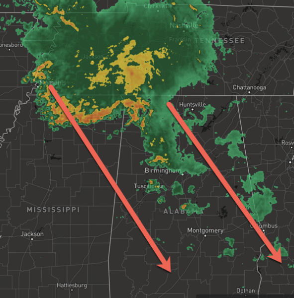
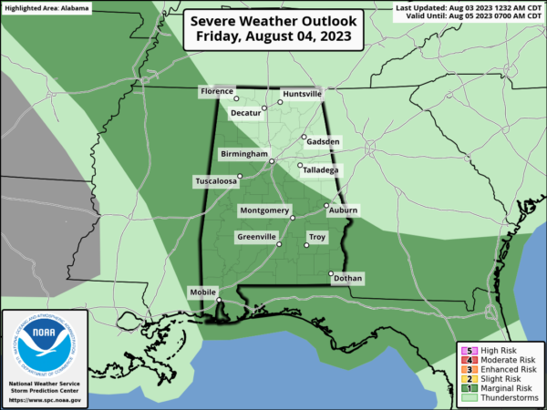
It is a wet and stormy Friday across Alabama as numerous showers and storms continue to move northwest to southeast across the state today, around the ridge to our west. The SPC maintains a “marginal risk” (level 1/5) of severe thunderstorms for roughly the southern 2/3 of the state.
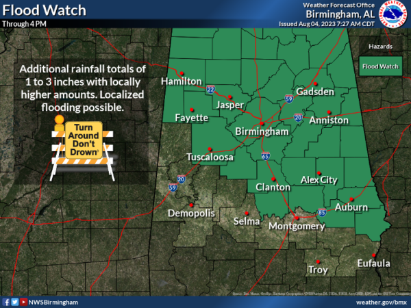
Again, damaging wind gusts will be the main threat with storms the rest of today. Heavy rainfall is an issue today as well and much of North/Central Alabama remains under a Flood Watch as areas of flash flooding are possible as 2-4 inches could fall in spots. Several flood warnings are already in effect across the state. Remember to never drive through flood waters.
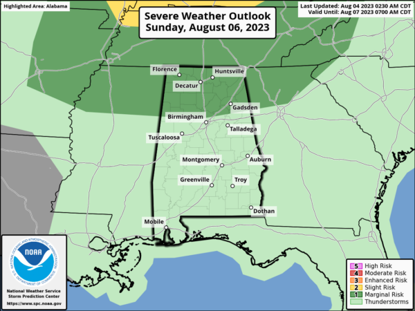
WEEKEND WEATHER: Hot and humid weather will persist this weekend and during the afternoon and evening hours, thunderstorms will develop across the state. These will be completely random, so you will have to watch radar trends both days. All summer storms will again produce gusty winds, heavy rainfall, and loads of lightning. It won’t rain everywhere, and it will remain hot with afternoon highs in the low to mid 90s. Heat index values will likely be over 100° as well. We note, the SPC has the northern third of Alabama under a “marginal risk” of severe storms Sunday afternoon.
INTO NEXT WEEK: For now, it doesn’t look like the weather pattern for the second week of August will be much different than the first week. Scattered afternoon showers and storms will be possible on each afternoon to early evening. Highs will generally be in the low to mid 90s.
IN THE TROPICS: All is quiet and no tropical cyclone development is expected through the weekend.
BEACH FORECAST CENTER: Get the latest weather and rip current forecasts for the beaches from Fort Morgan to Panama City on our Beach Forecast Center page. There, you can select the forecast of the region that you are interested in visiting.
WORLD TEMPERATURE EXTREMES: Over the last 24 hours, the highest observation outside the U.S. was 121.6F at Kuwait International Airport, Kuwait. The lowest observation was -100.8F Vostok, Antarctica.
CONTIGUOUS TEMPERATURE EXTREMES: Over the last 24 hours, the highest observation was 114F at Death Valley, CA. The lowest observation was 33F at Angel Fire, NM.
Category: Alabama's Weather, ALL POSTS
About the Author (Author Profile)
Macon, Georgia Television Chief Meteorologist, Birmingham native, and long time Contributor on AlabamaWX. Stormchaser. I did not choose Weather, it chose Me. College Football Fanatic. @Ryan_StinnetSubscribe
If you enjoyed this article, subscribe to receive more just like it.


