Saturday Weather Briefing — Strong to Severe Storms Possible Over the Weekend
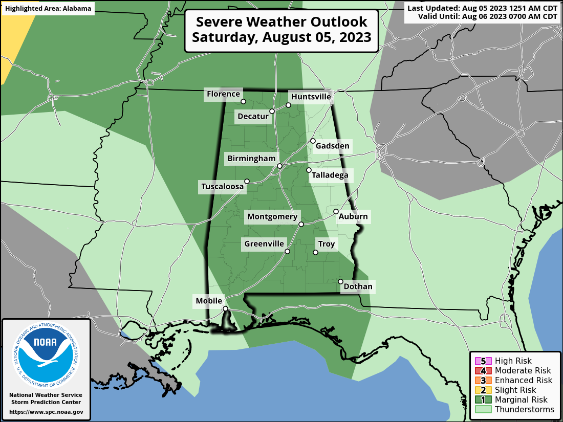
We’re starting off with some dense fog and clouds in the area this morning, but those will dissipate through the morning. However, we’ll have a shortwave, that may develop into an MCS this afternoon, move into the northern parts of the area and bring rain and storms, some of which may be strong to severe. Much of North and Central Alabama are under a Marginal Risk for severe storms through the day today for the risk of damaging straight line winds. Highs in the 90s, with the western and southwestern parts of the area under a Heat Advisory.
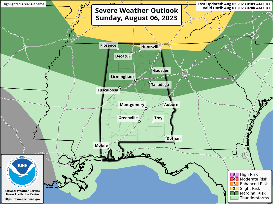
A more zonal flow takes over the weather pattern on Sunday that will keep us hot and humid. Scattered afternoon showers and storm can be expected, but we may have a boundary move in that could increase the convection during that time. The northern half of the state is under a Marginal Risk, while the very extreme north and northeastern parts of North Alabama are under a Slight Risk. Once again, damaging straight line winds will be the threat. Highs in the 90s.
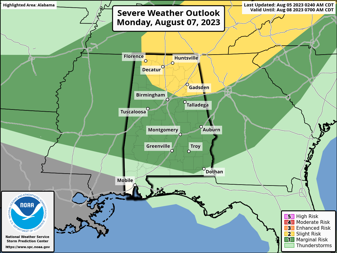
A good portion of the northern parts of the area is under a Slight Risk for Monday as a cold front will begin to move into the area and later stalling out over the central portions of Central Alabama. The rest of the area is under a Marginal Risk, as damaging winds and large hail will be the main threats. Instability will already be high with the high heat and humidity, but wind shear and steeper mid-level lapse rates mixed in, there is a chance for stronger to severe storms. Highs in the 90s.
With the cold front stalled over the area on Tuesday, a few disturbances are progged to move across the northern parts of the area. More scattered showers and storms are expected, especially during the afternoon and evening hours. While there is no defined severe risk, we’ll have to watch for a few stronger storms. Highs in the mid 80s to the mid 90s.
Much of the same on Wednesday as another impulse is set to move across the northern parts of the area with rain and storms likely, while scattered showers and storms will be possible for the rest of Central Alabama. Once again, strong storms will be possible. Highs in the mid 80s to the lower 90s.
And again on Thursday, another wave will move across the northern parts of the area, and scattered showers and storms will be possible for the rest of Central Alabama. Highs in the mid 80s to the mid 90s.
And at the end of the forecast period on Friday, rain and storms will be possible across all of Central Alabama, especially during the afternoon and evening hours. Highs in the upper 80s to the mid 90s.
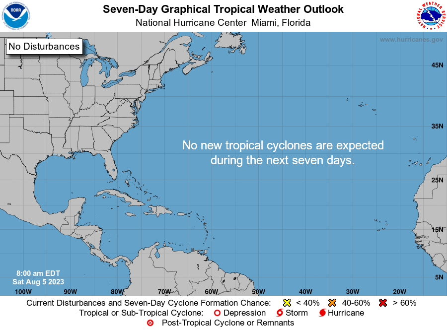
The tropics are all extremely quiet as we have hit the peak of hurricane season. No tropical cyclones are expected to develop during the next seven days.
Category: Alabama's Weather, ALL POSTS, Severe Weather, Tropical, Weather Xtreme Videos
About the Author (Author Profile)
Scott Martin is an operational meteorologist, professional graphic artist, musician, husband, and father. Not only is Scott a member of the National Weather Association, but he is also the Central Alabama Chapter of the NWA president. Scott is also the co-founder of Racecast Weather, which provides forecasts for many racing series across the USA. He also supplies forecasts for the BassMaster Elite Series events including the BassMaster Classic.Subscribe
If you enjoyed this article, subscribe to receive more just like it.


